Experience our 27 mile North to South Rim hike across the Canyon (with Ribbon Falls detour added)!
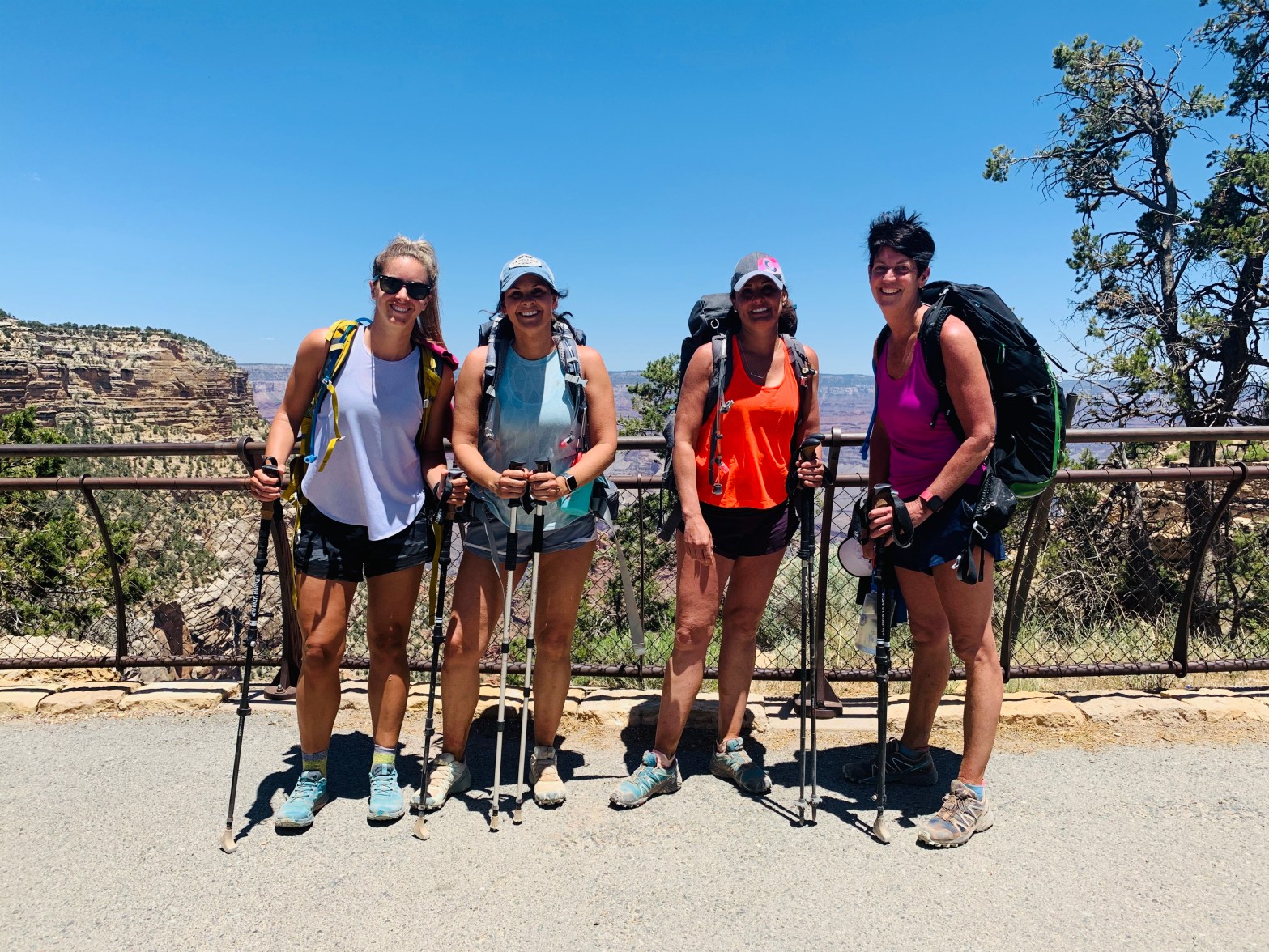
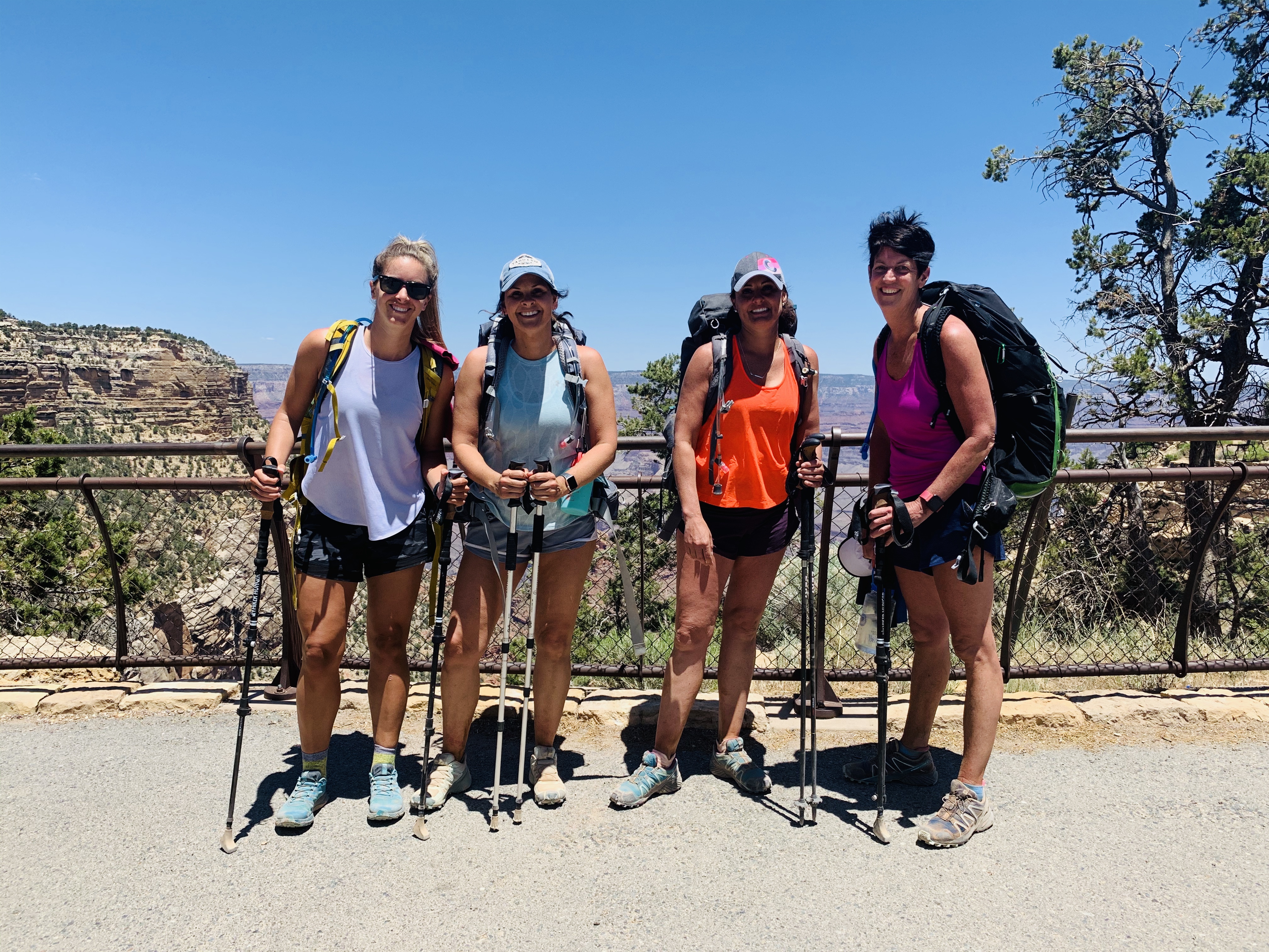
Millions of people visit the Grand Canyon’s South Rim each year but VERY few go to the North Rim and even less venture into the depths of the canyon. In September 2019, myself and three girlfriends sat at the Lodge of the North Rim watching the sunrise and vowed to return to the canyon to conquer our first Rim to Rim a few months later in 2020. Never did we expect all the barriers that would get in our way!
In January, we set our dates for June to hike our first R2R and decided to do North to South after reading reviews and wanting to be at our car and done at the end instead of having to shuttle back 4 hours to our car. We decided to draft out an itinerary for a 1-day hiking option and a 2-day hiking option if we were lucky enough to be accepted for the lottery submission of a campground spot at Bright Angel Campground at the bottom of the canyon. A separate post will explain the exact logistics of obtaining that permit but luckily we were approved in February so we started planning our hotels/lodging, shuttle, etc for a 2-day hike across the canyon. We were ecstatic to have 2 days so we would not have to rush, could take in all the views, and we could see Ribbon Falls. As COVID-19 hit and continued to cancel portions of our plans (North Rim Lodge not opening in time, shuttle not running to get us the 5 hours to the North Rim, etc), we just needed the actual canyon to open and our camping permit to be honored to make this R2R happen. Our hike was June 10-11 and the NPS officially opened the North Rim and the canyon on June 5 and our permit was officially approved to be utilized! We were ecstatic! Little did we know the North Rim would close the day after we went through due to Magnum Fire closing the entire road to the rim. We were SO lucky to have our R2R fall within the 5 days the North Rim was open in 2020!
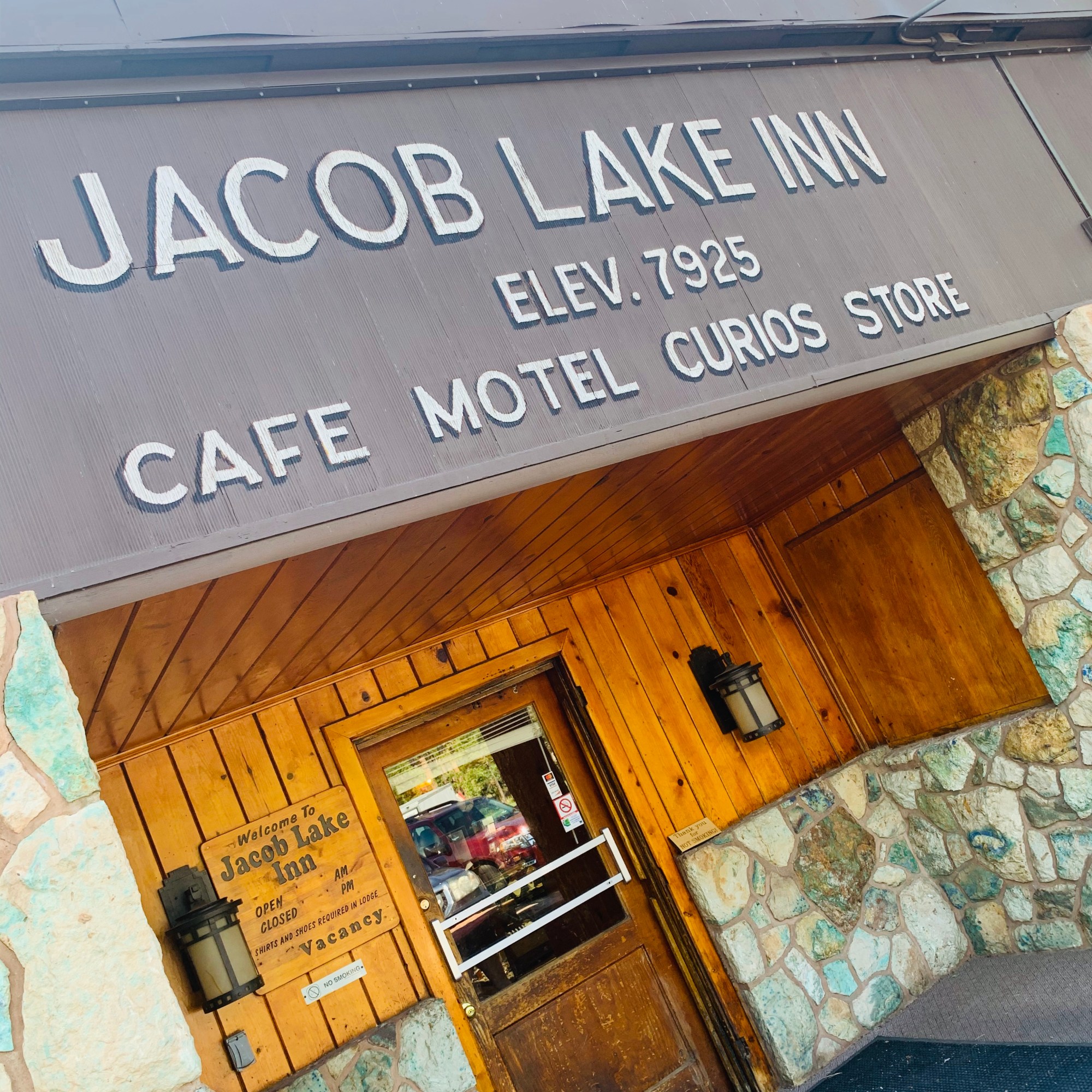
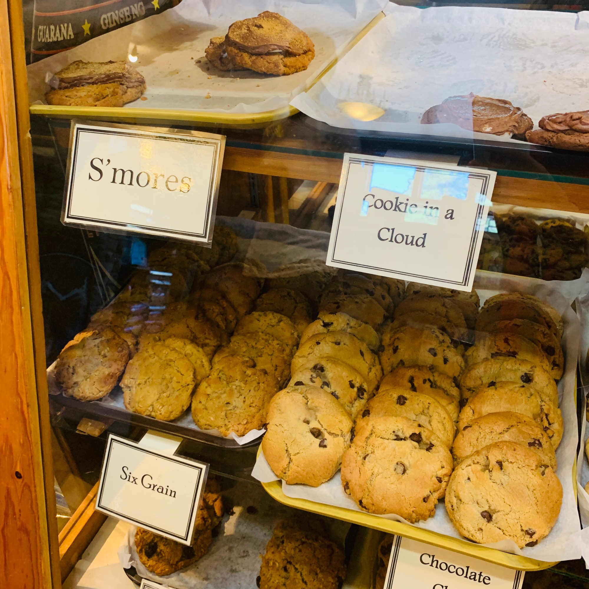
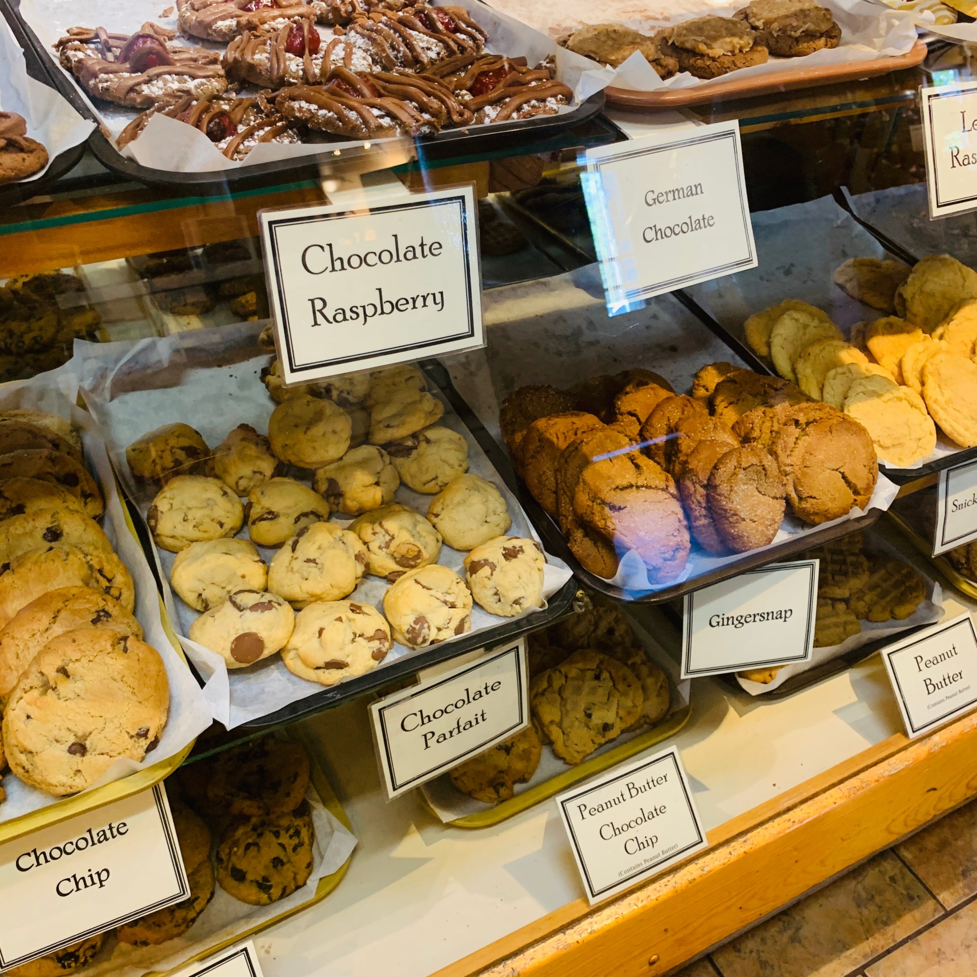
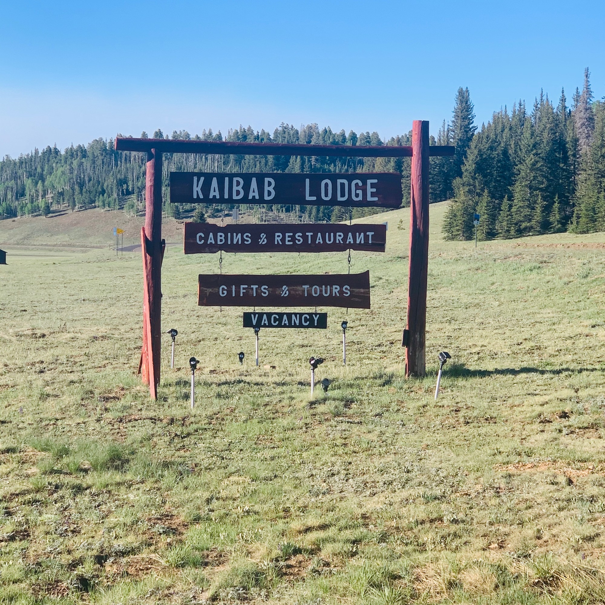
Thankfully one of the ladies in our group’s brother lives in Phoenix and was willing to drive us the 5 hours from the South Rim to the North Rim the day before our hike (can you say “Saint”!?!) where we ate dinner and got AMAZING cookies at Jacob Lake Inn on our way to Kaibab Lodge where we stayed the night before our adventure (North Rim Lodge canceled our reservations due to not being opened yet due to COVID-19). If you have not had Jacob Lake Inn cookies, you’re doing life wrong!
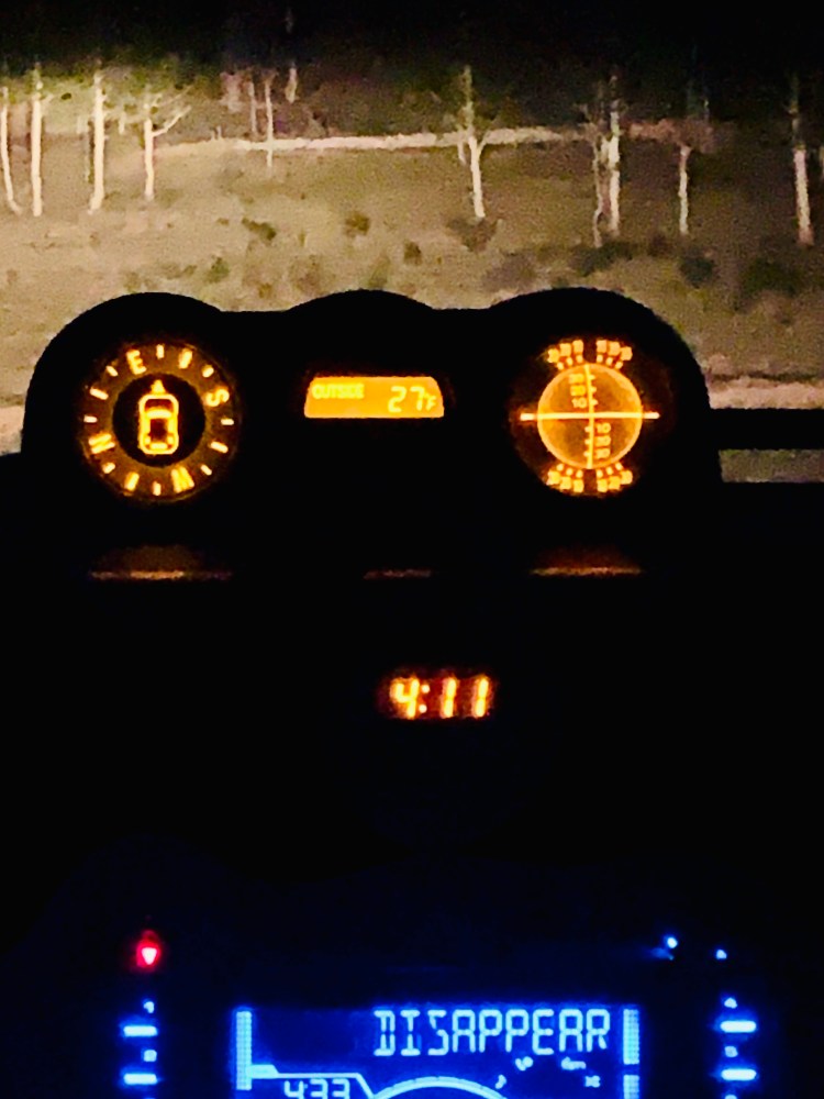
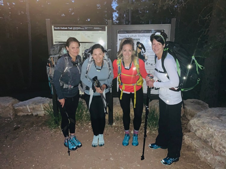
We went to sleep around 8 PM to gear up for our big day ahead! We left the lodge at 4:15 AM and got to the North Kaibab (NK) Trailhead to start our hike at 4:45 AM. It was 27 degrees and still dark out (sun came up around 5:15 so we didn’t need our headlamps long). We all had hiking poles and adrenaline was kicking in as we began our 5,000 foot descent for the day! With our planned detour to Ribbon Falls, we knew we had 17 miles before we got to our campsite at the bottom for the night. Due to camping and doing it over 2 days, we each had 20-25 pound packs on our back with our gear, food, and water.
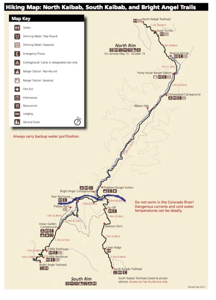


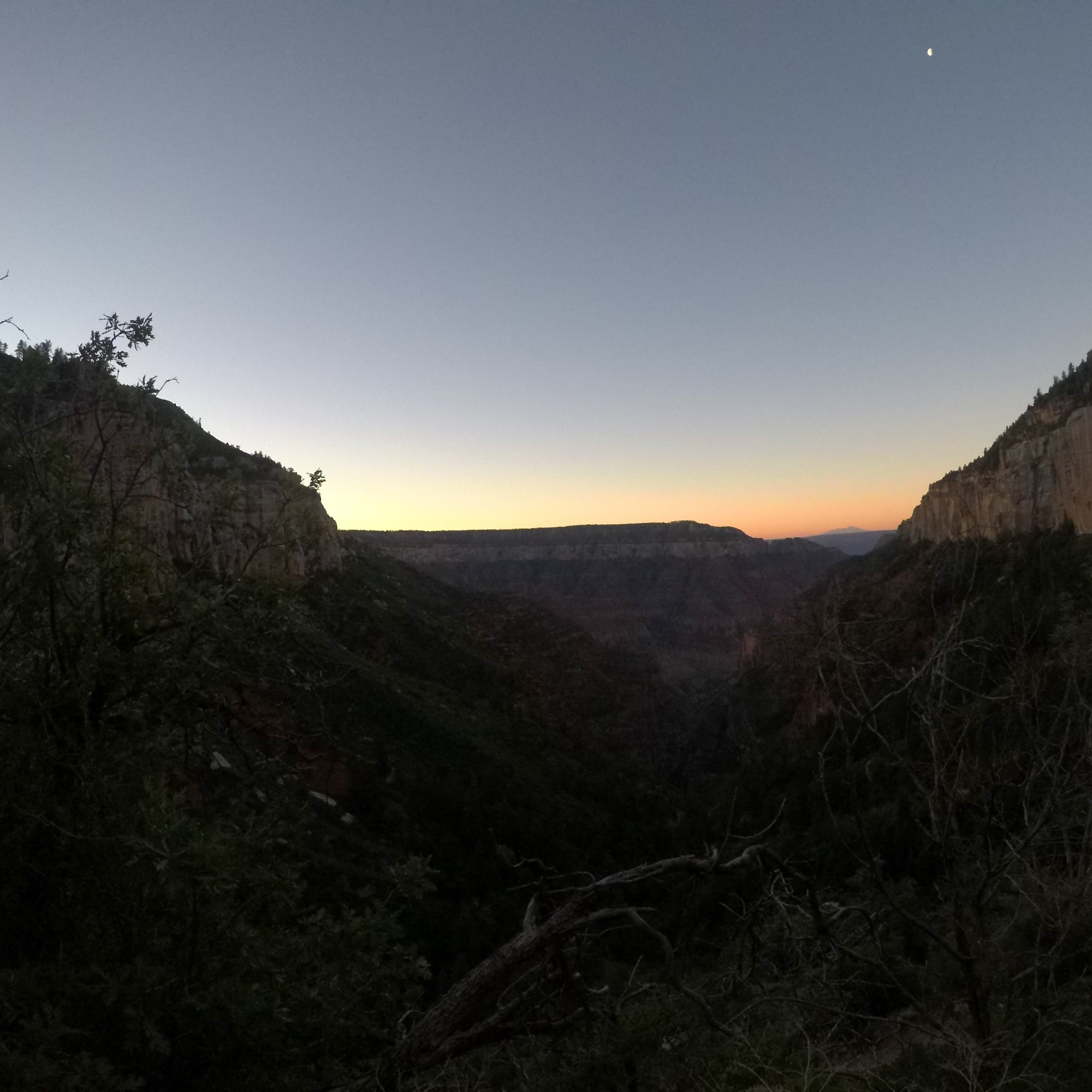
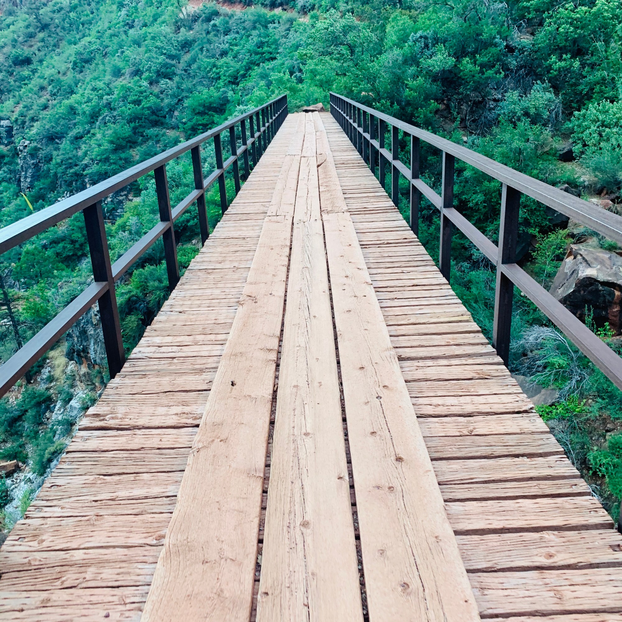
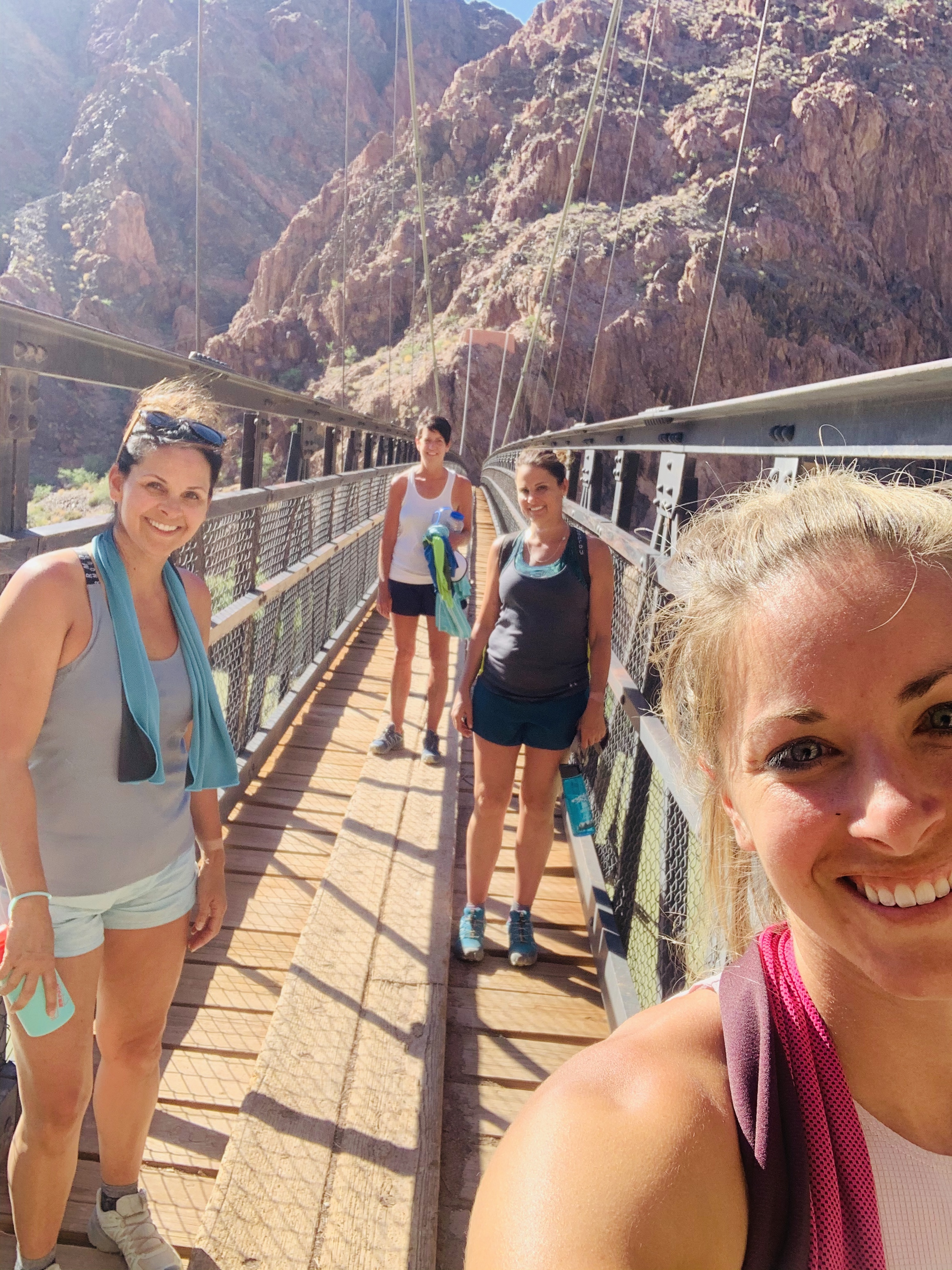
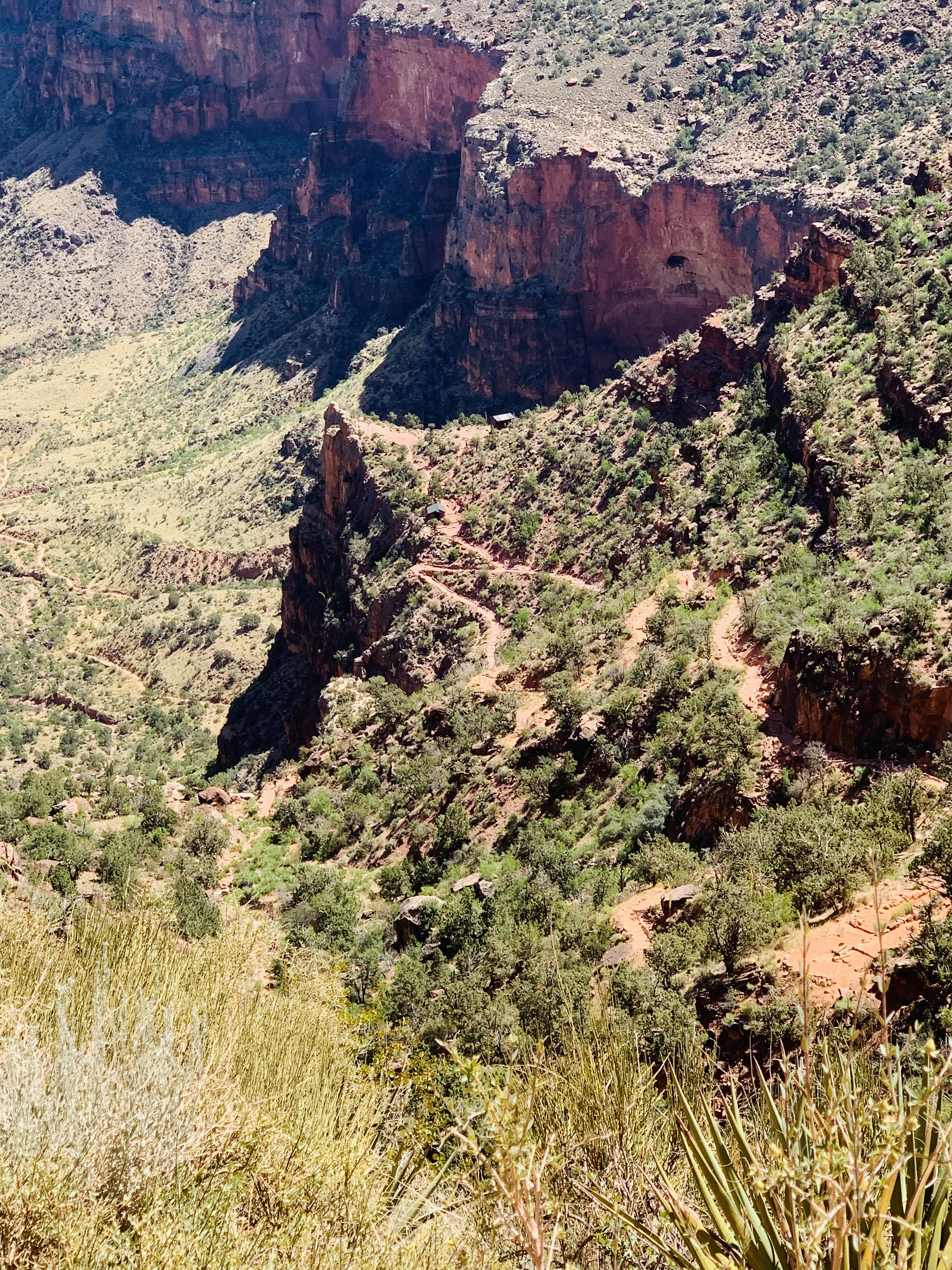
We worked our way down the trail, admiring the 15 foot high blooming agave, how well kept the trail was, and how grateful we were for this experience to take place! On the North Kaibab (using NK here forward) in the first 6 miles, there are switchbacks, bridges, and views all the way across the canyon.
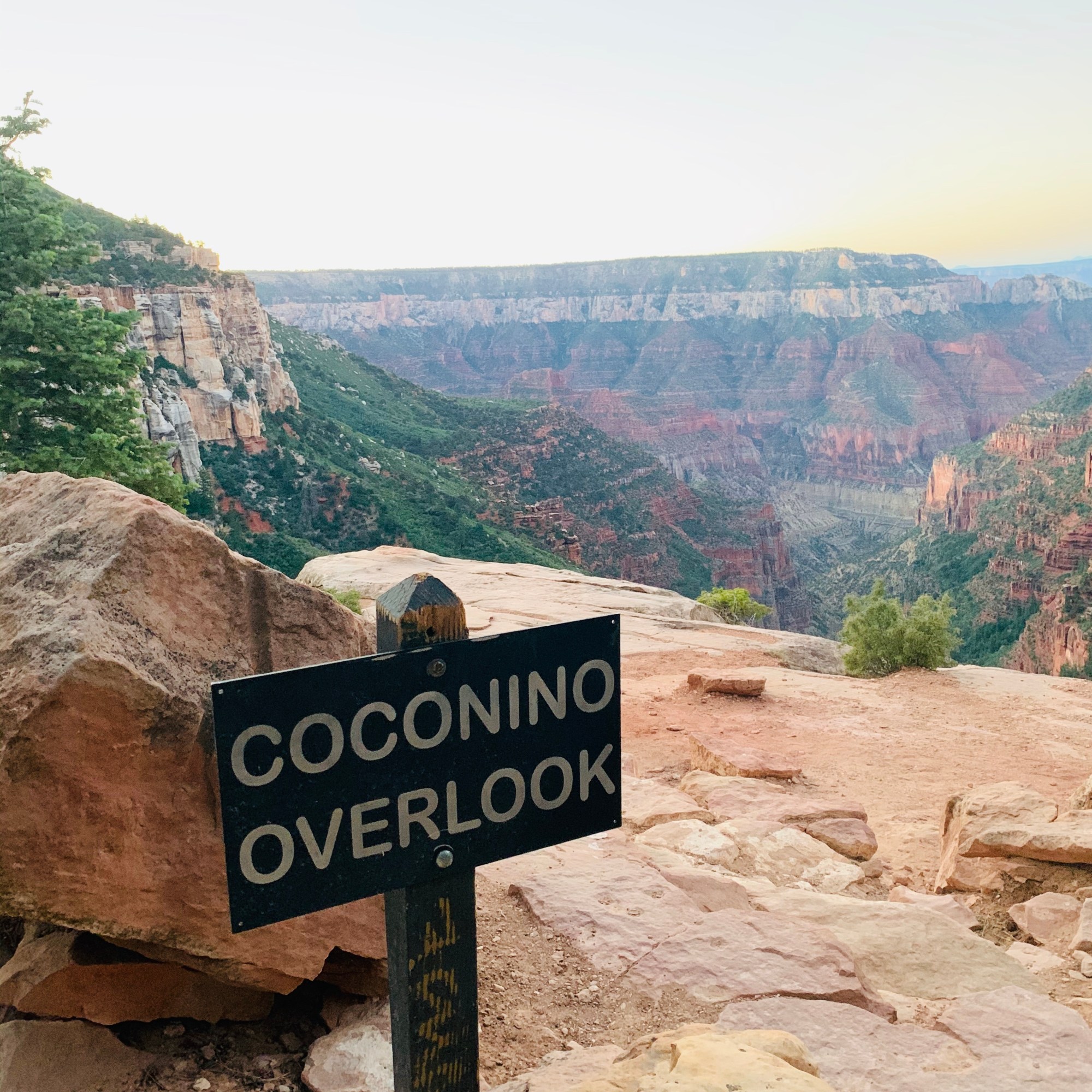

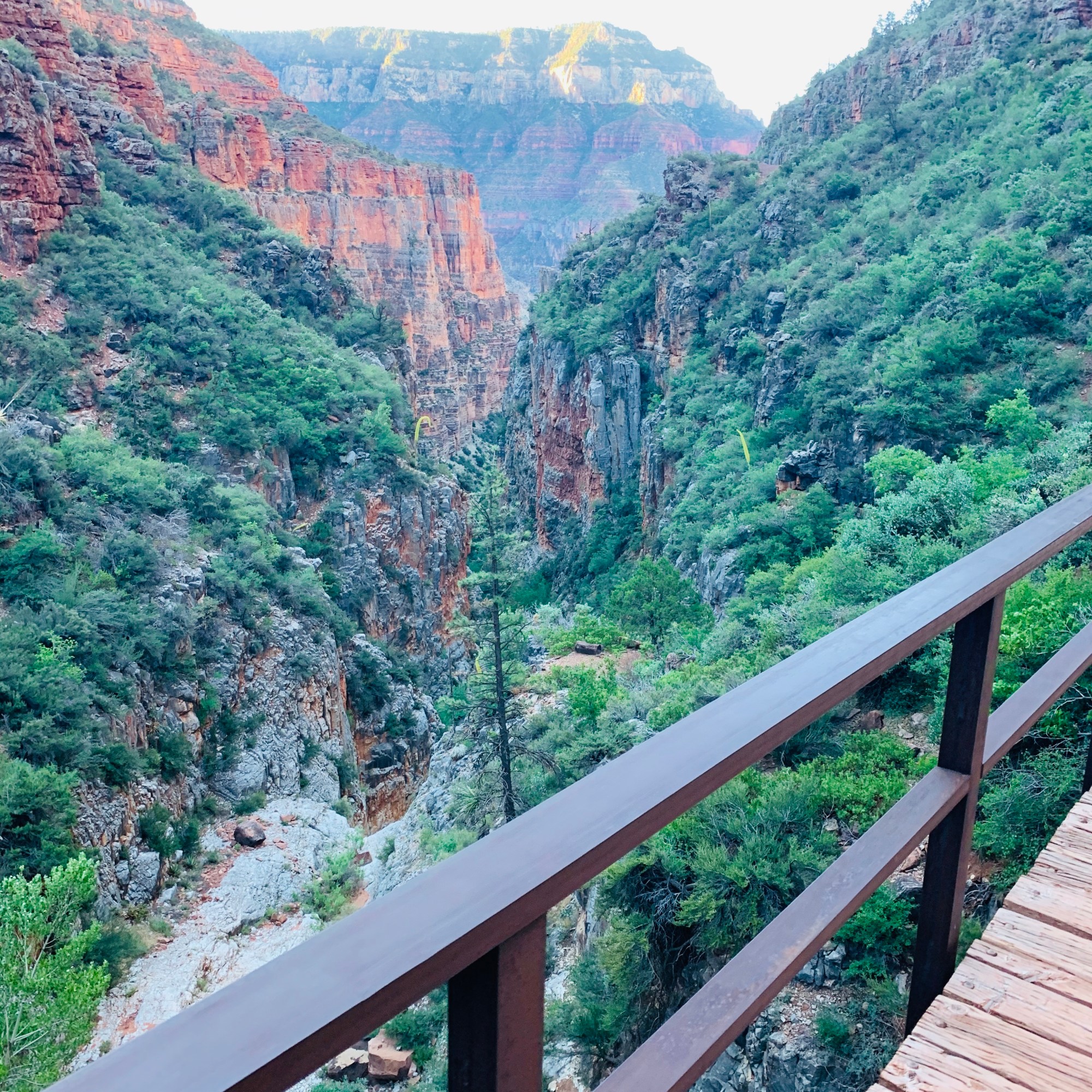
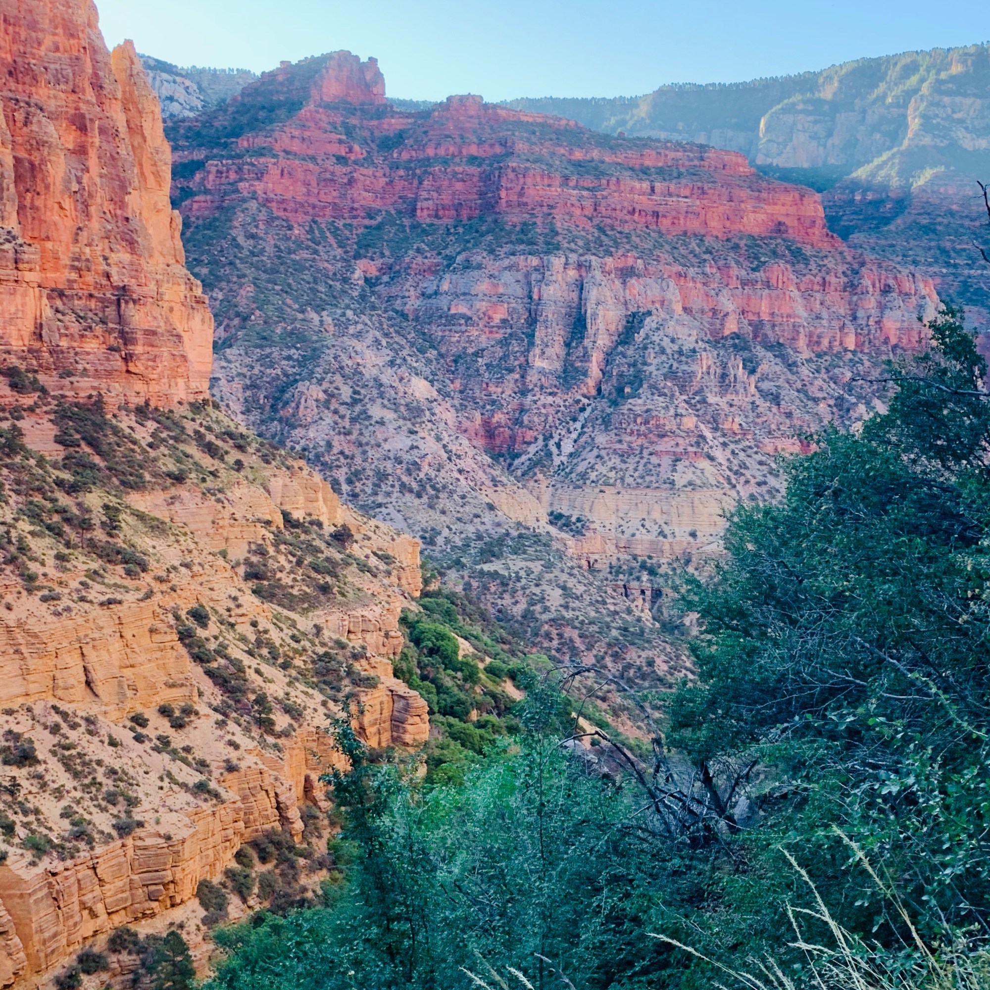
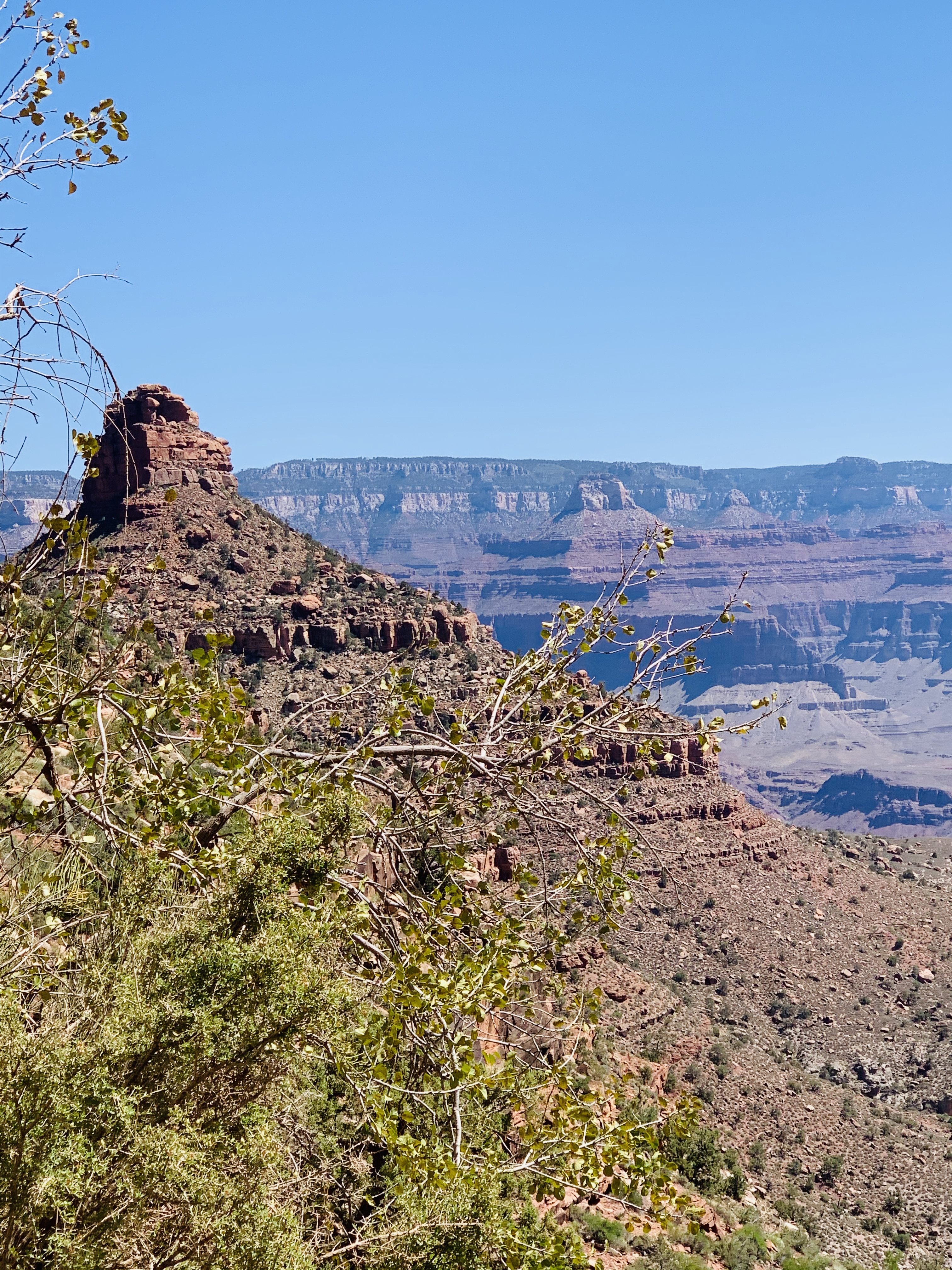
About 5 miles down the NK is the view across the canyon of Roaring Springs which is a powerful waterfall that actually is the sole water source for Grand Canyon National Park! You can see the water pipeline MANY times along the R2R hike! It produces potable water for hikers to drink at the many fill-up spots. (TIP: always check NPS site to ensure which water sources are in working order before your hike as many pipeline breaks occur!). The waterfall is incredible to see and flows all the way down the canyon wall.


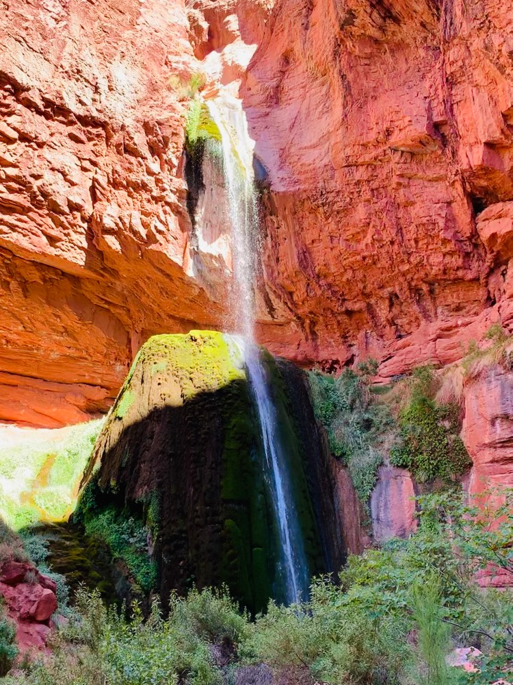
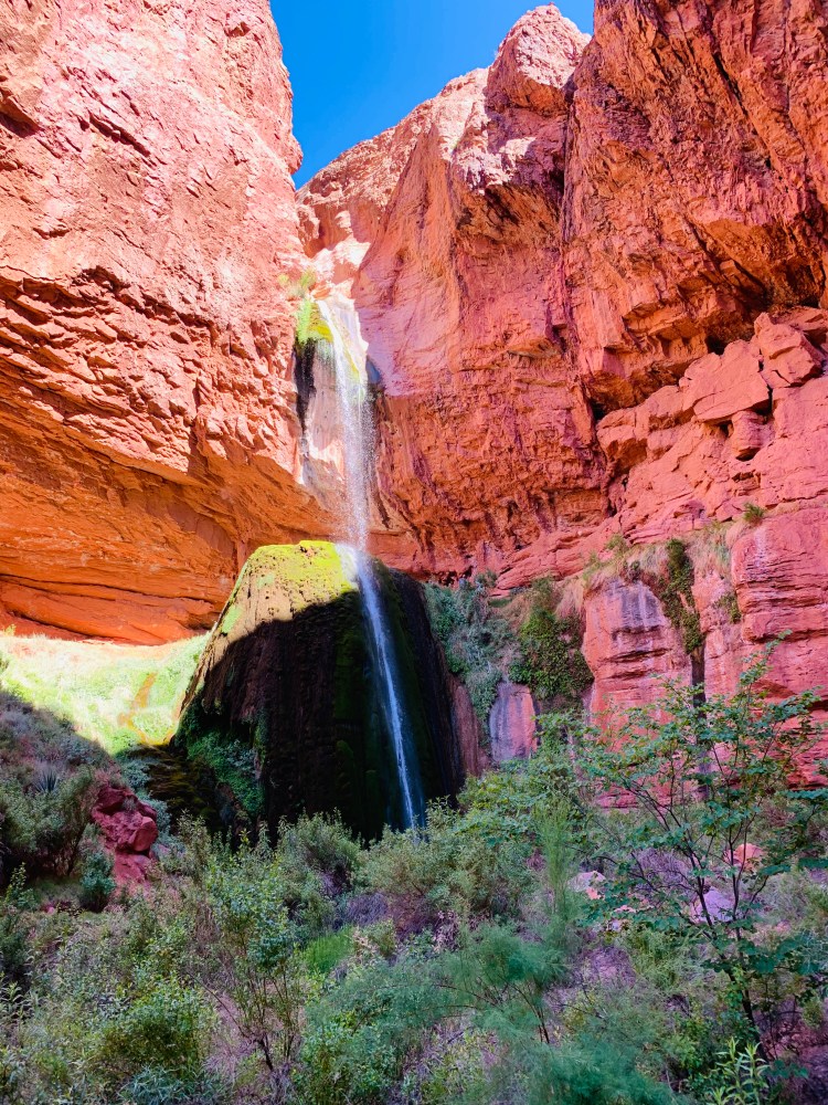
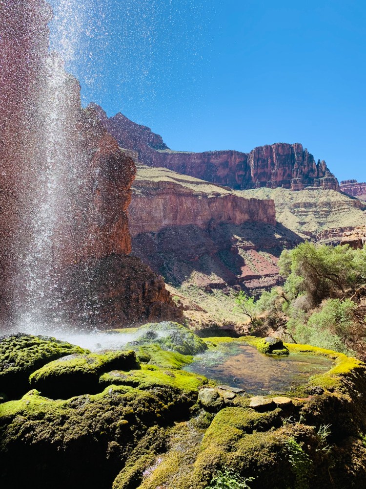
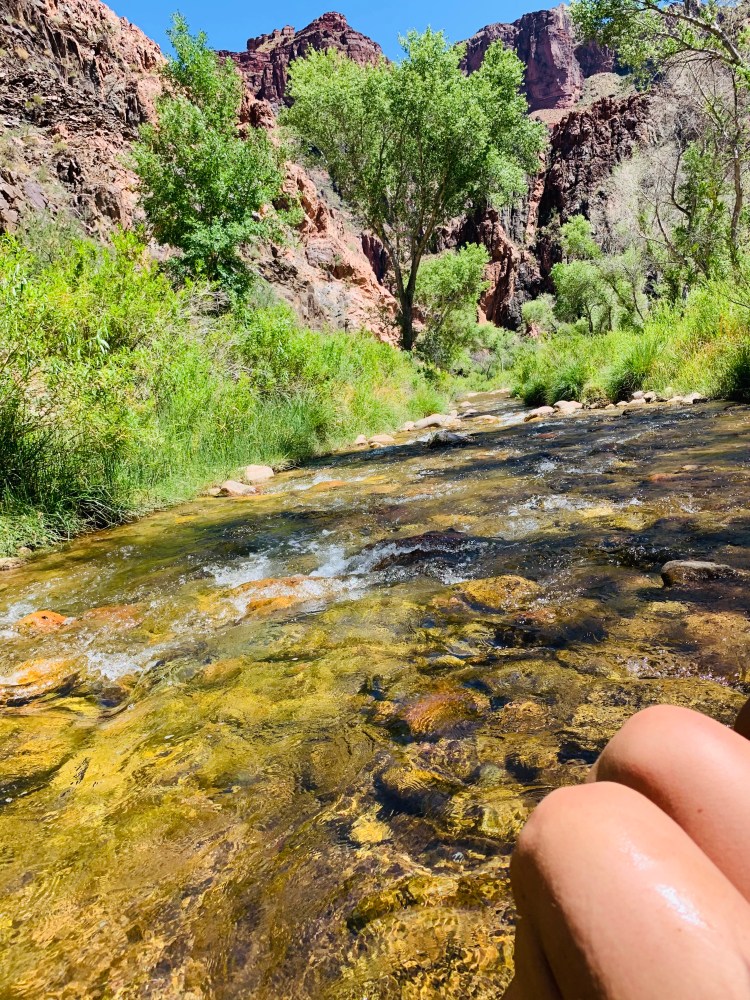
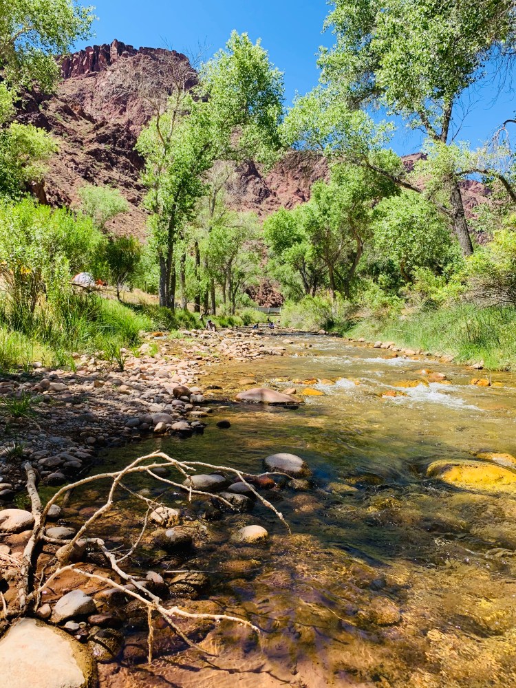
The next area we came to was Manzanita Rest Area where there were bathrooms and water. We took a quick ~10 minute break to use the rest rooms and eat a snack before continuing on. About 7 miles (from top), we reached Cottonwood Campground where we encountered only 1 campsite of the 15 being utilized. Looking back, at this point we absolutely should have topped off our water supply as it is the last source of water (besides the creek where you have to filter) until after The Box and you get to Phantom Ranch (lesson learned!). About a mile and a half further, we got to a sign that said “Ribbon Falls bridge” and we followed it knowing the bridge was out but thinking this was the way everyone had told us to cross the creek by foot. Two in our group dropped off their bags and we all found an area where we could cross the shin-deep creek (about 8-feet wide). We got to the other side and eventually found a little makeshift trail toward Ribbon Falls. When we got within about 0.25 miles of the falls, there is a sign that points you back to the NK Trail but via a much easier creek route (we just hadn’t gone far enough–half mile further on main trail and we would have seen it/known that way to take). So at this point, the two girls that dropped their bags went back for them while myself and another got to the falls to enjoy for about a half hour while our other friends returned, sans backpacks due to not recalling exactly where we crossed the creek and thinking it is better safe than sorry for us to all stay together (smart move!). So we all took in Ribbon Falls before heading back for the bags and the trail as we knew we were a bit behind schedule on getting to The Box before the hottest time of day (and in June!).


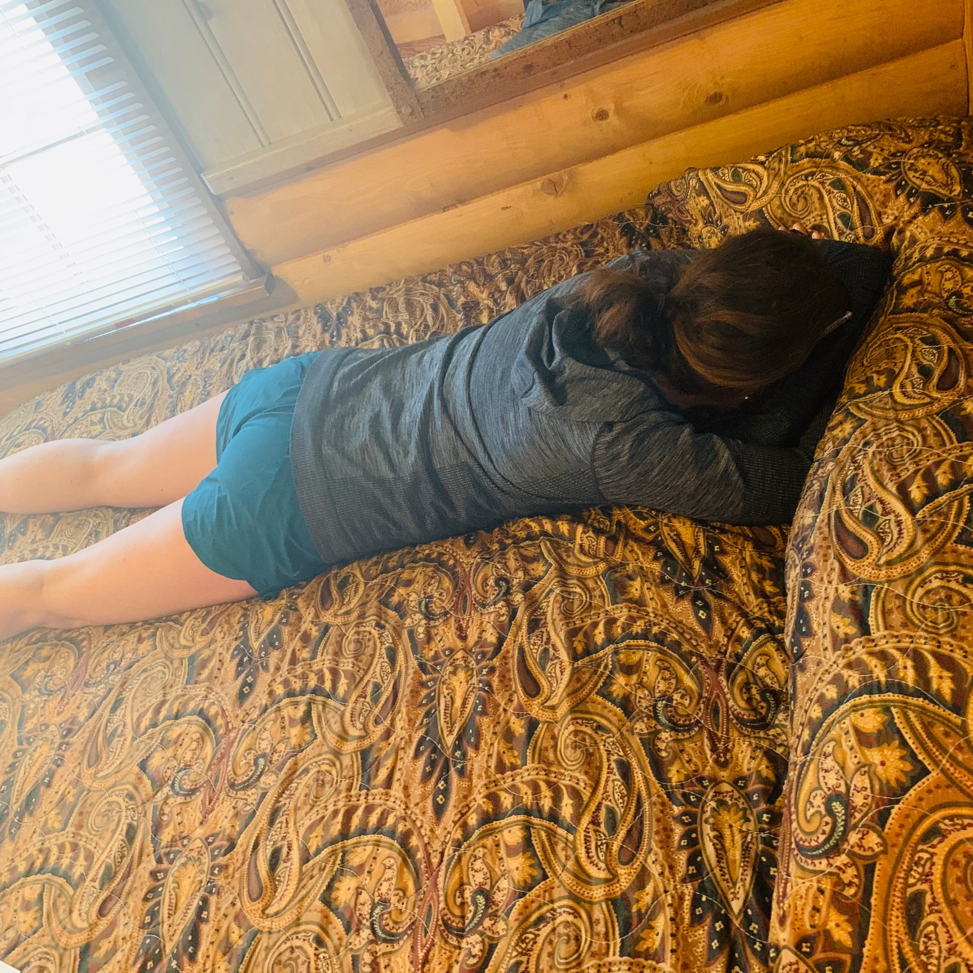
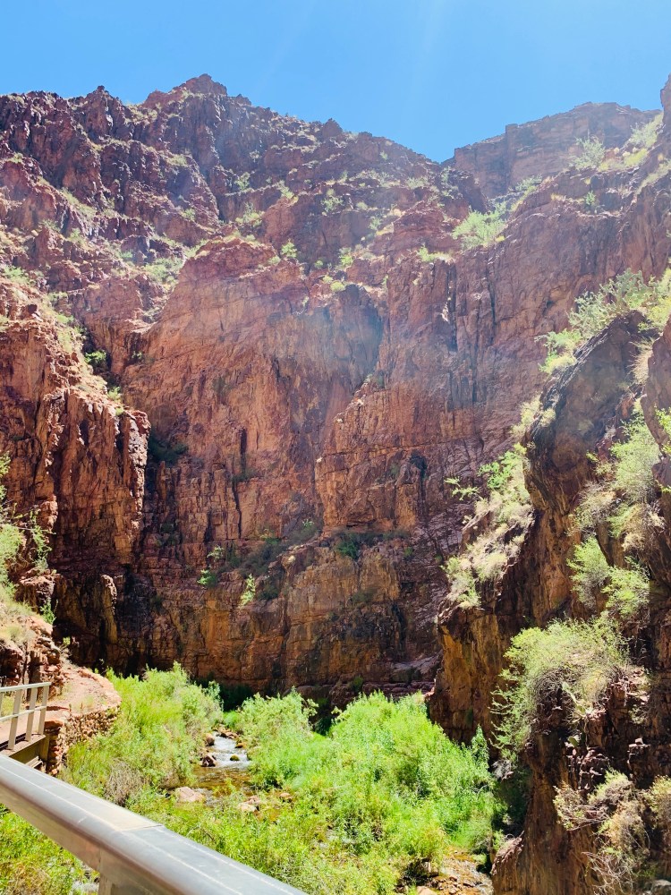
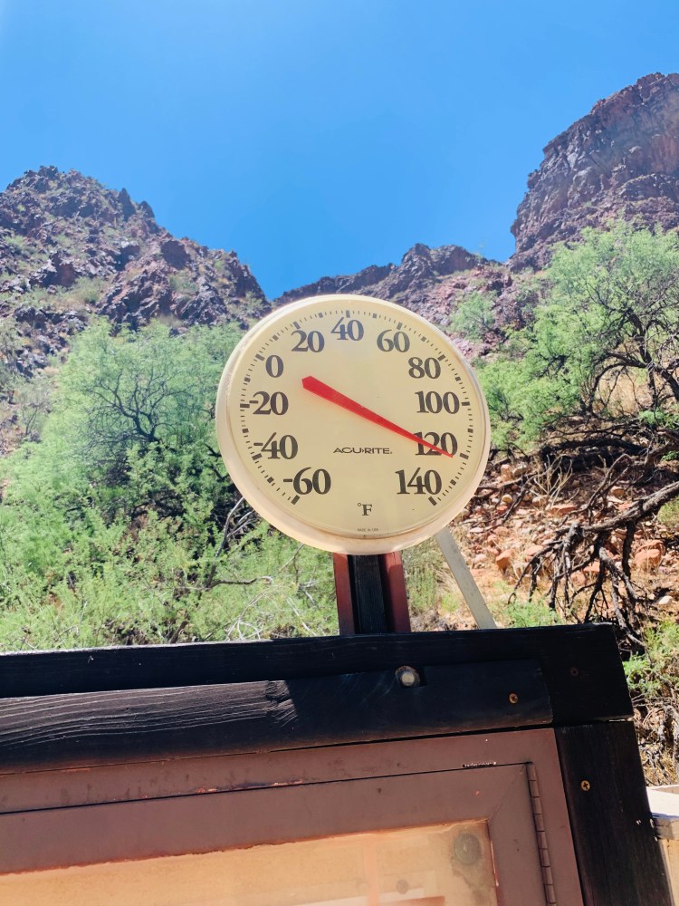
We navigated our way back across the creek to the dropped bags and got back on the main NK Trail. This is where one in our group had a sudden bout of heat exhaustion. She sat down, we all acted quickly to cool her down with dripping water all over her, putting cooling towels on her, getting an ice pack from our First Aid Kit on her neck, and salt tabs in her system. After 5-10 minutes of rest and cooling down, she was back full force and ready to tackle the last 7 miles to the campground! We got to The Box (which is the narrowest part of the canyon and just traps heat) at about 10 AM. We decided to keep moving slowly but to relax in the shade to keep ourselves as cool as we could and our heart rates low. Thankfully (honestly probably saved our lives), there was a nice breeze through The Box at the time we went through that made it less miserable than it could be! Unfortunately with about a mile to go in The Box and about 2 miles to the campground, all four of us ran out of water (oh crap moment for sure)! Looking back, we should have all topped off at Cottonwood but thankfully we all had water purification methods with us and the creek was close to the trail with a little route down to it. We all got our water bottles filled and sterilized (had a UV steri-pen to kill bacteria) and were ready to continue on. We made it through The Box and knew we didn’t have far to go. We came upon the best sign of the entire trek that was the 3/4 mile to Bright Angel Campground sign! We ventured through Phantom Ranch which was completely empty (besides one deer) due to it still being closed due to COVID-19. It was eerie walking through (and we had only seen 11 people total in the previous 16 miles at this point!). We made it to the campground where we dropped our gear and went and just laid on the rocks in Bright Angel Creek for several hours. The temp was 100 degrees higher at the bottom of the canyon than what it was at the top that morning!


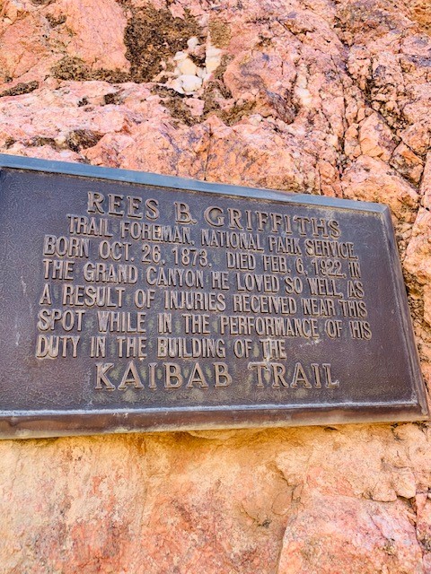
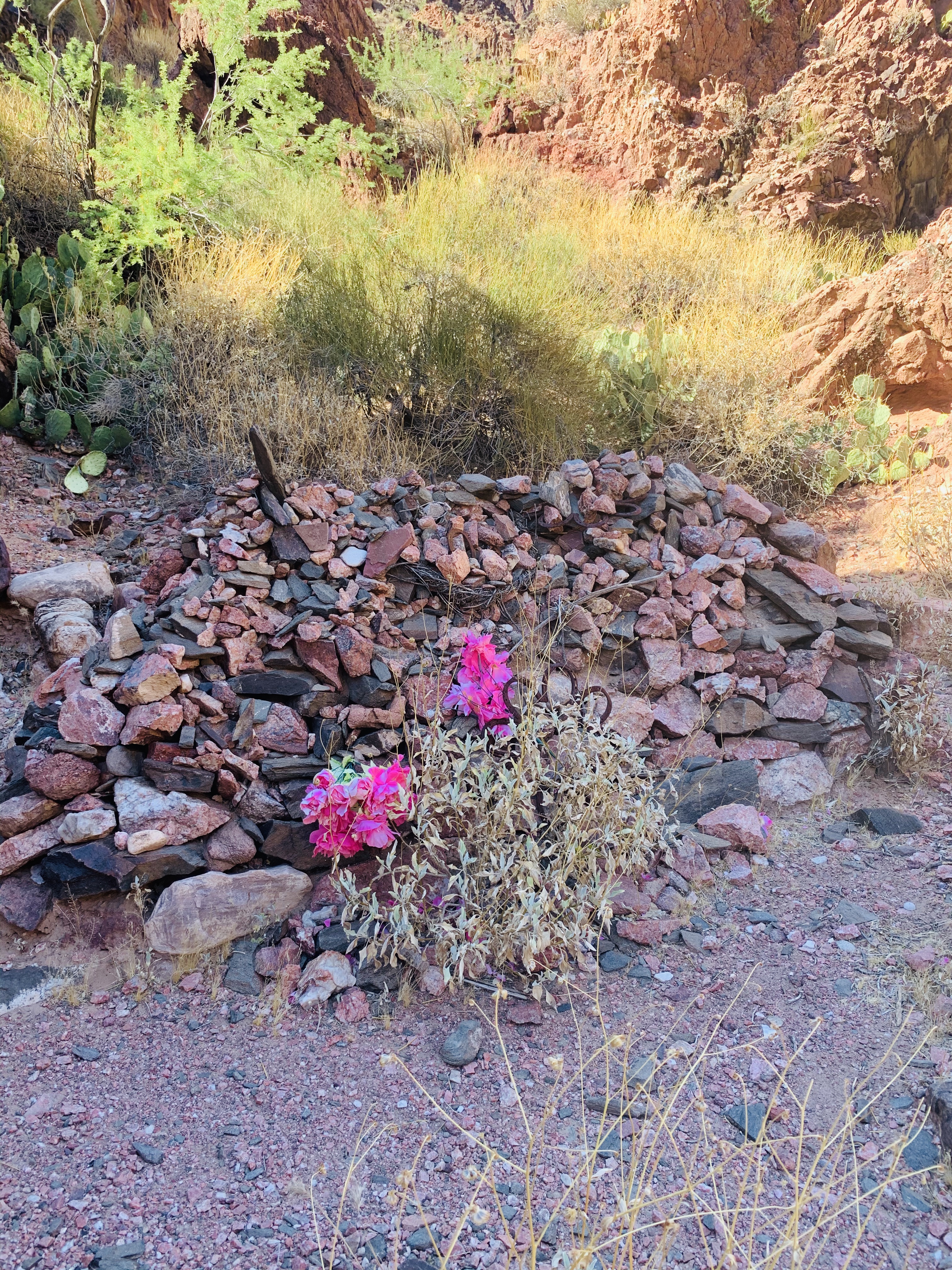
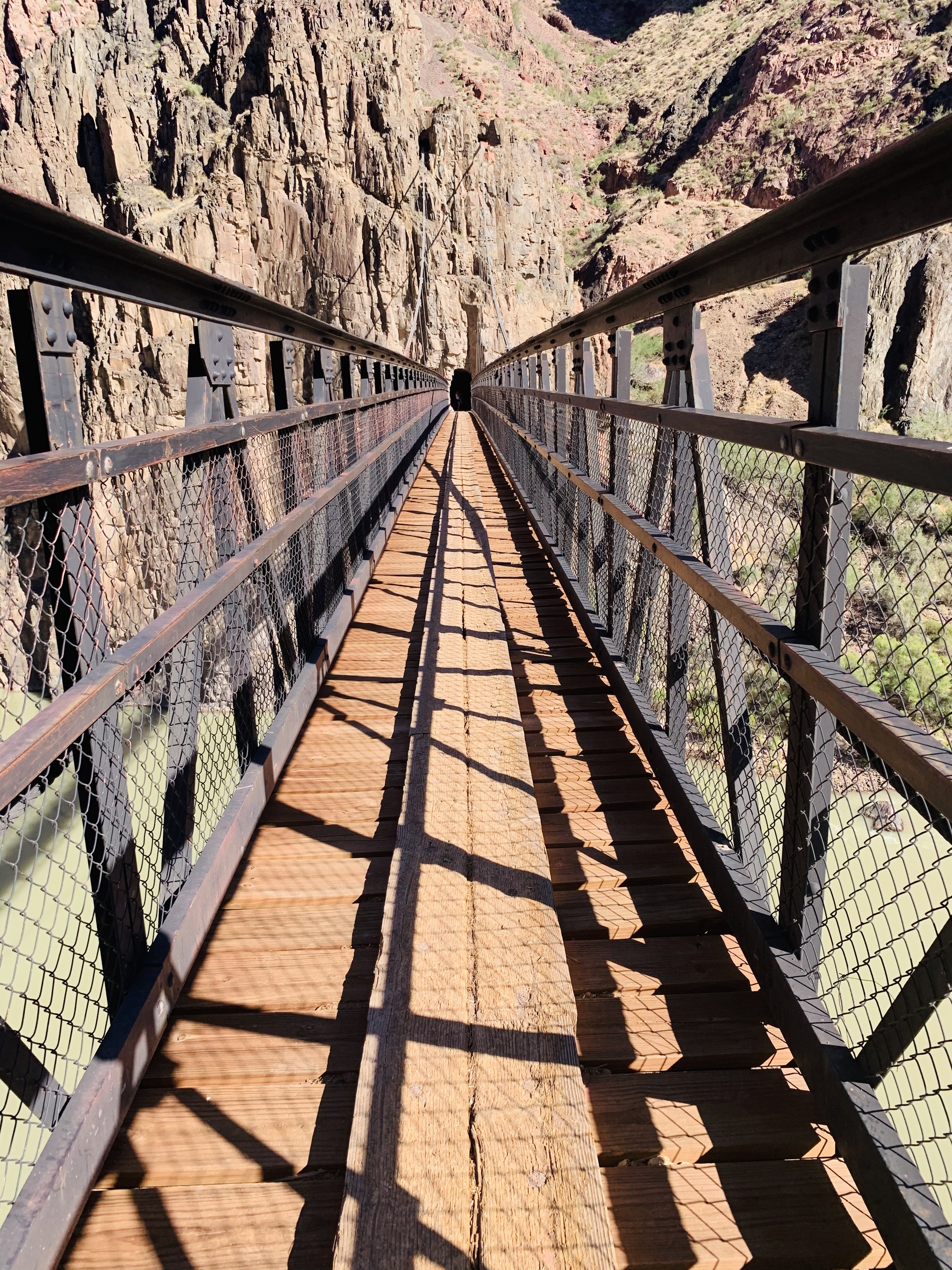
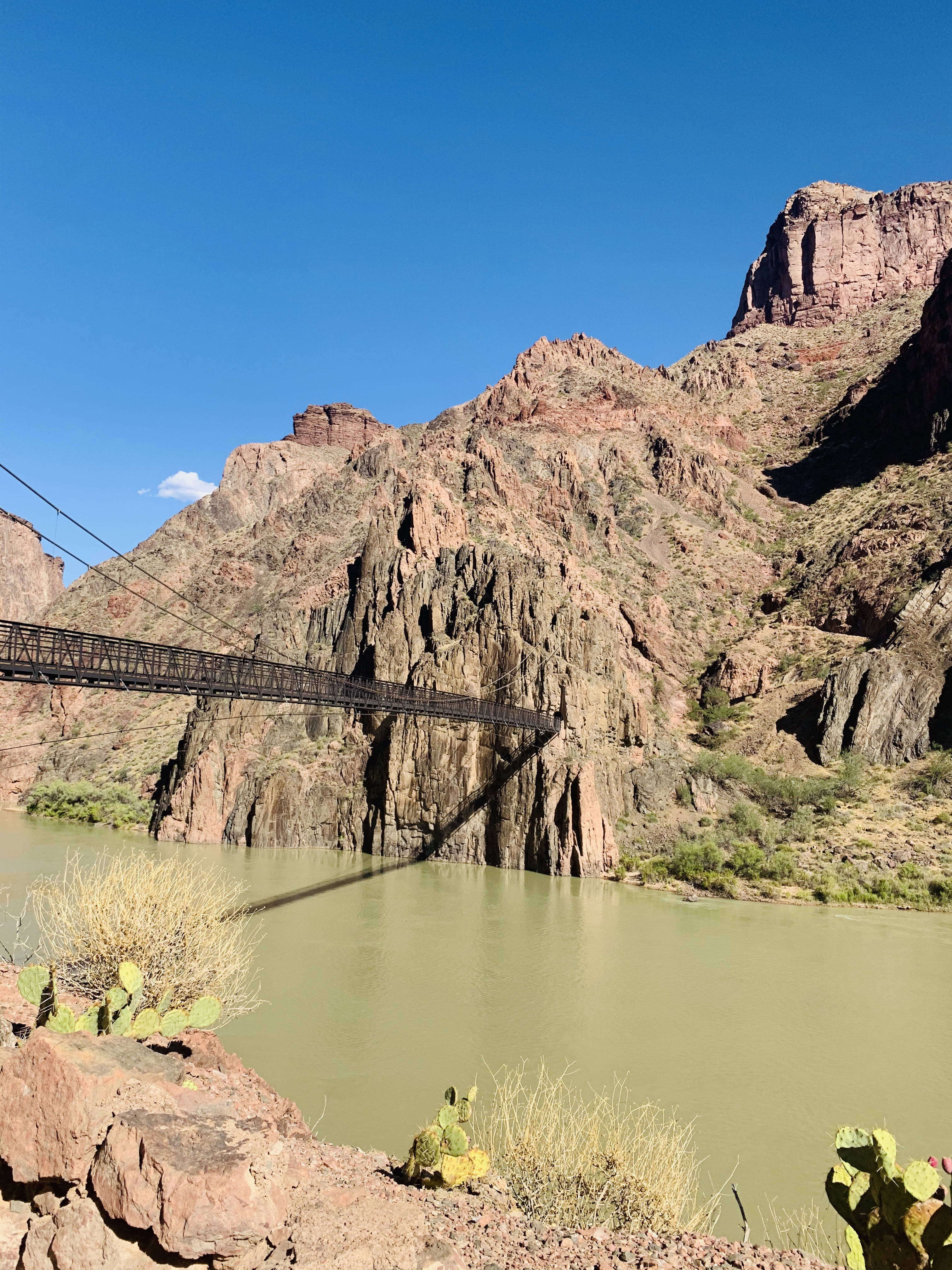
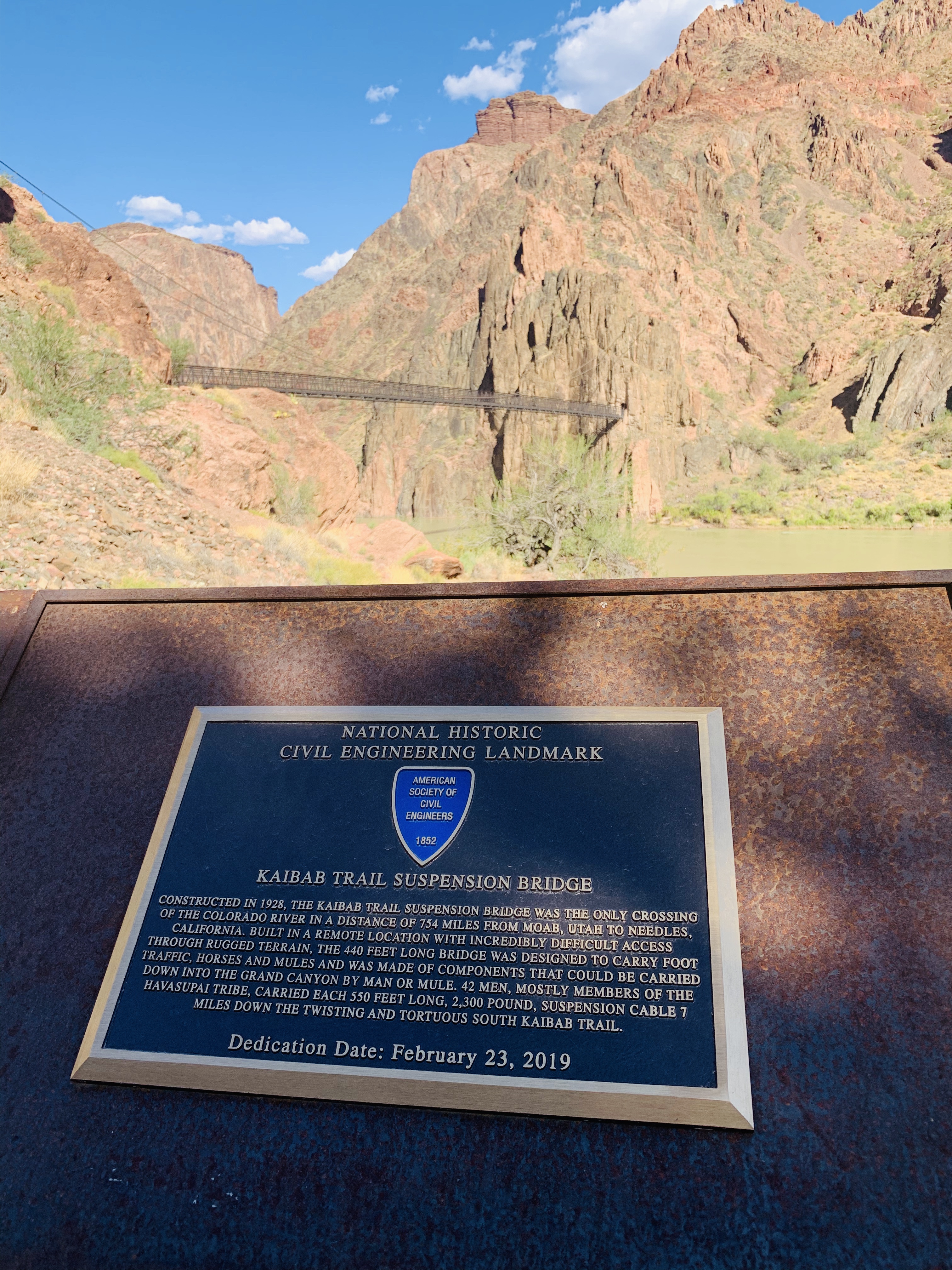
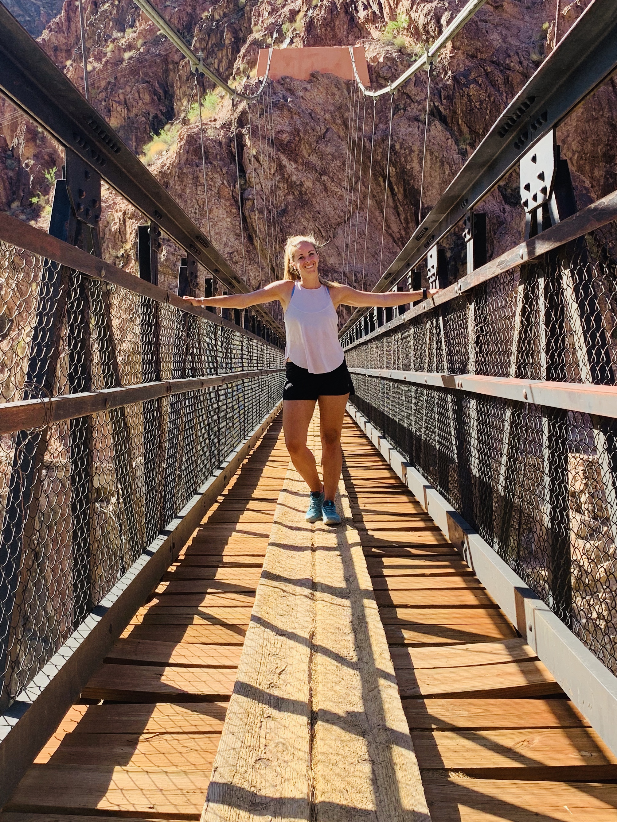
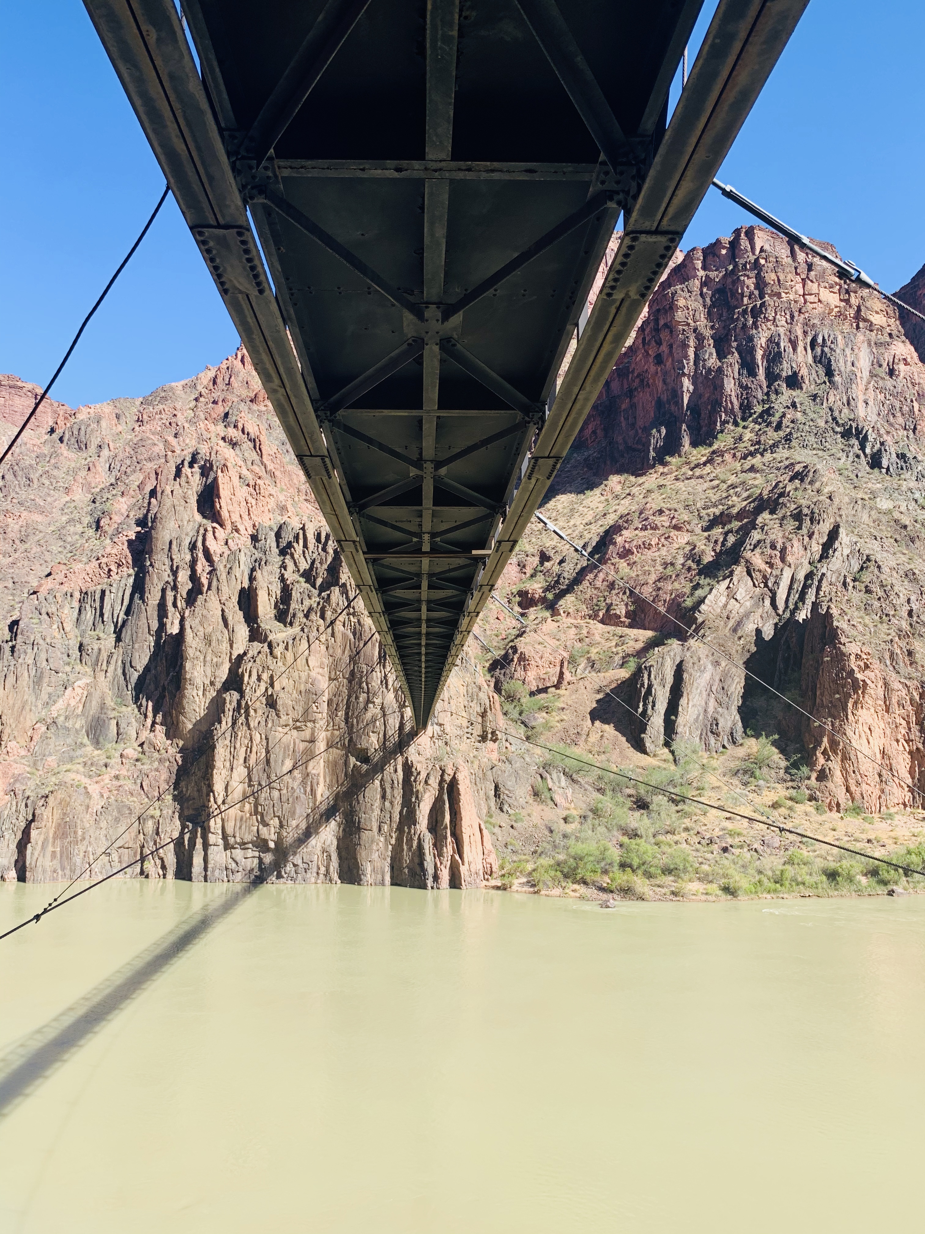
After cooling off and coming back to life a bit, we wanted to walk the half mile to the Kaibab Trail Suspension Bridge as we heard it was beautiful and a not-to-miss view. On the way to the bridge, there is a burial for a foreman of the Bright Angel Trail who died on duty while building the Kaibab Trail (photo below). We paid our gratitude for his work on the trail! The Suspension Bridge spans the 440 feet across the Colorado River and is how (via mules) supplies get down into the canyon for Phantom Ranch! Read the plaque below to learn more about it, it is fascinating how it was built. Also, it is the only bridge the mules use to cross the river because the bottom is boarded and you cannot see through it to the moving water below (which scares the mules)!

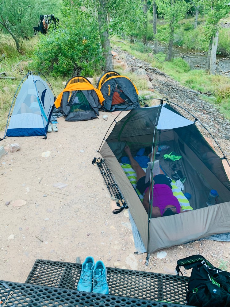
After seeing the bridge, we took the 10 minute walk back to our campsite and set up our tents for the night. When all four of our tents were complete, we started making dinner (at about 6 PM). We had Backpacker’s Pantry Pad Thai which included everything but the boiling water! It was fantastic and 2 packets fed the four of us. If you are looking for a freeze dried meal, this one was fantastic! It was the perfect mix of carbs/fat/protein and the sodium we were craving! Following dinner, we got changed and crawled into our tents for the night! It was still about 90 degrees when we laid down so no blanket was necessary until about 2 AM when I woke up and put my light microfiber blanket over me a little and went back to sleep until 3 AM when I heard my friend chasing a ring tailed cat out of her backpack (yes, seriously haha!) At 4:45 AM, we woke up to tear down our tents, have coffee, and hit the trail by 5:45 AM.


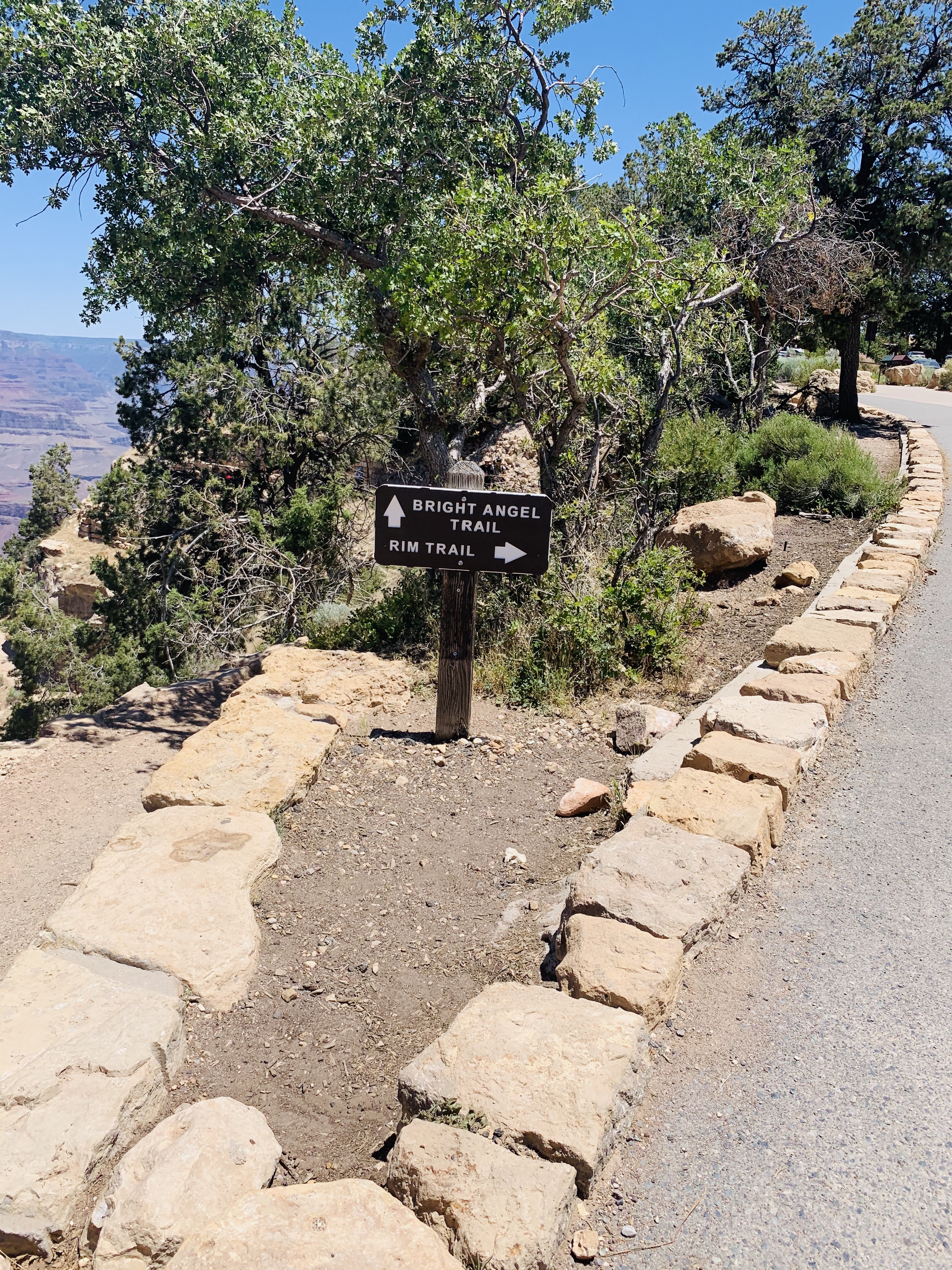
The sun was up by the time we started hiking up Bright Angel (BA going forward) Trail. The first mile was just getting through the ranger and mule lodging and crossing Silver Bridge until you get to deep, loose sand for about a mile (wakes the calves up right away in the morning!). There was a River Resthouse about 1.5 miles into the trail and then you start going back and forth up switchbacks a little until you reach a very lush, cool area. We knew we were nearing Indian Garden Campground at this point and had made really good time for the first 5 miles of the day! Indian Garden was unexplainable– so green with grass as tall as our heads and 15 degree cooler temps, it was as it if just didn’t belong in the canyon but we were so grateful for it to cool us down for a bit! We took a break at the hut at Indian Garden and filled our water packs (learned from the day before!) before heading up the final 4.5 miles of switchbacks.


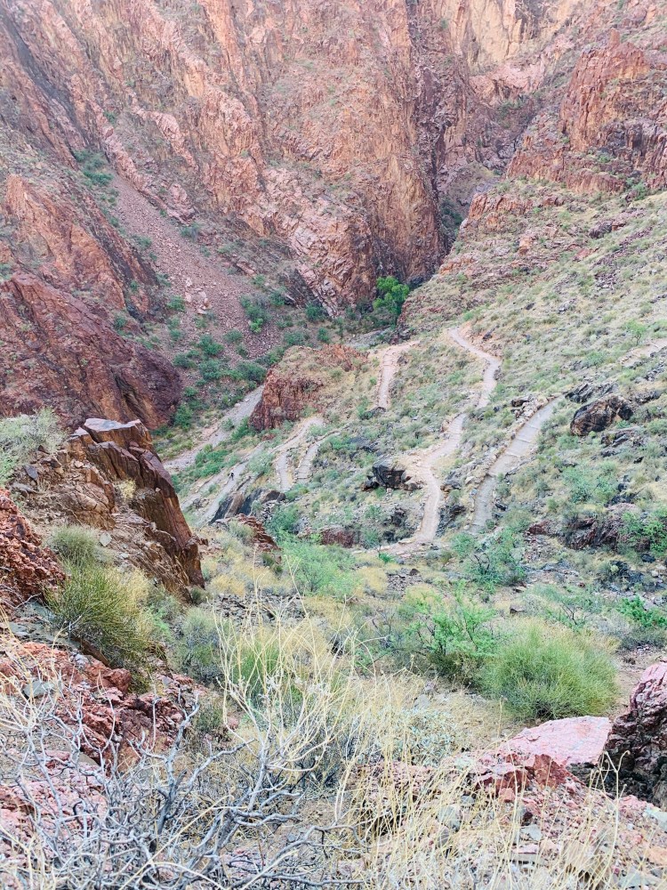
I ate more beef jerky this day than I’d like to remember and am slightly scorn from thinking about it for a while!! We made our way up Devil’s Corkscrew which is a series of severe switchbacks (photo below). At the 3 mile resthouse, we didn’t end up stopping but instead started to take breaks almost every quarter mile whenever shade popped up so we could cool down slightly and lower our heart rate. Remember we were climbing 5,000 feet (with majority of it being in the final 4 miles of our 10 mile day), with 20 pound packs on our back in 90 degree weather. I mean, this was NOT an easy feat by ANY means!! We started telling ourselves that it didn’t matter how slow we went, as long as we continued forward because each step was closer to the top! Also, my mantra was “if this were easy, more people would do it and it wouldn’t be a challenge”. The last 3 miles took us just as long, if not longer, than the first 7 miles that day. The last 3 miles are absolutely no joke!
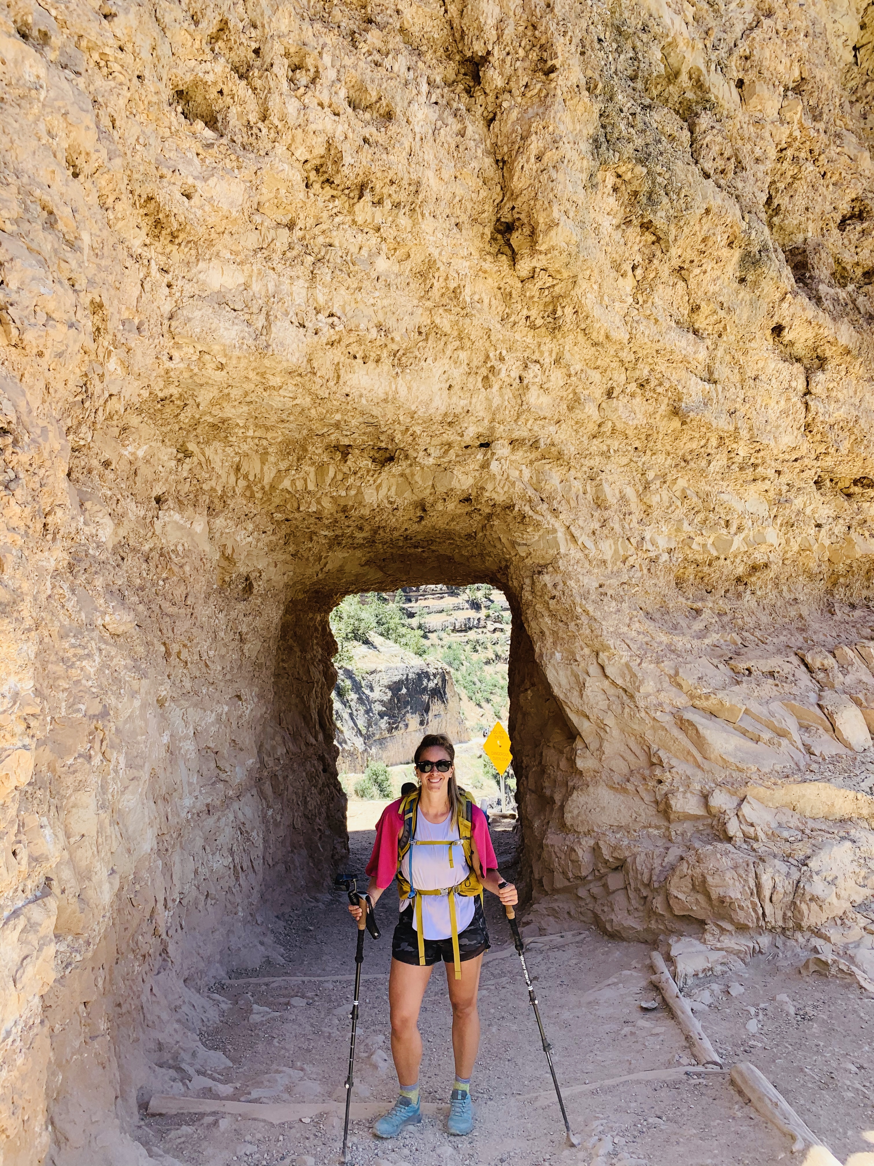
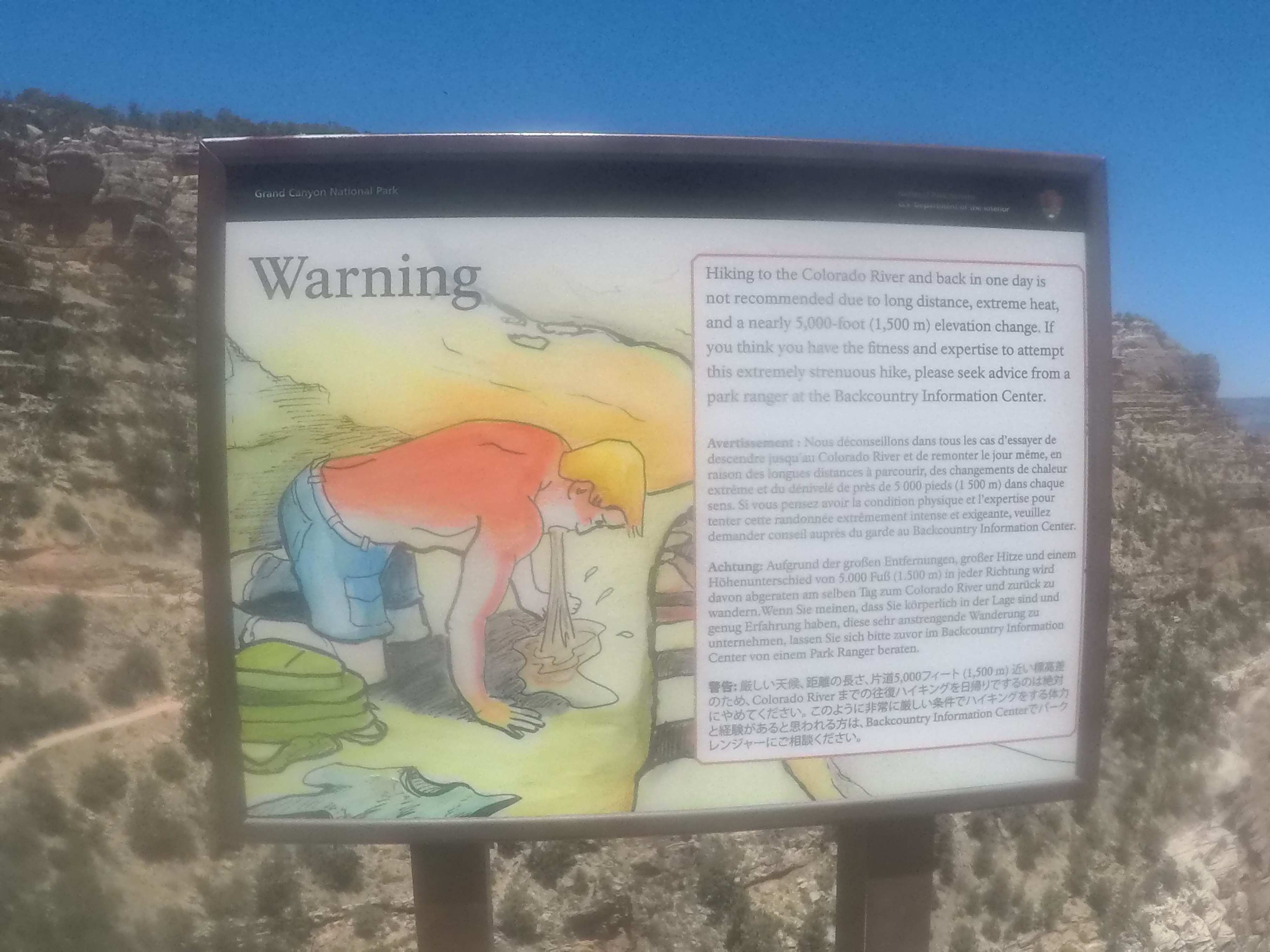
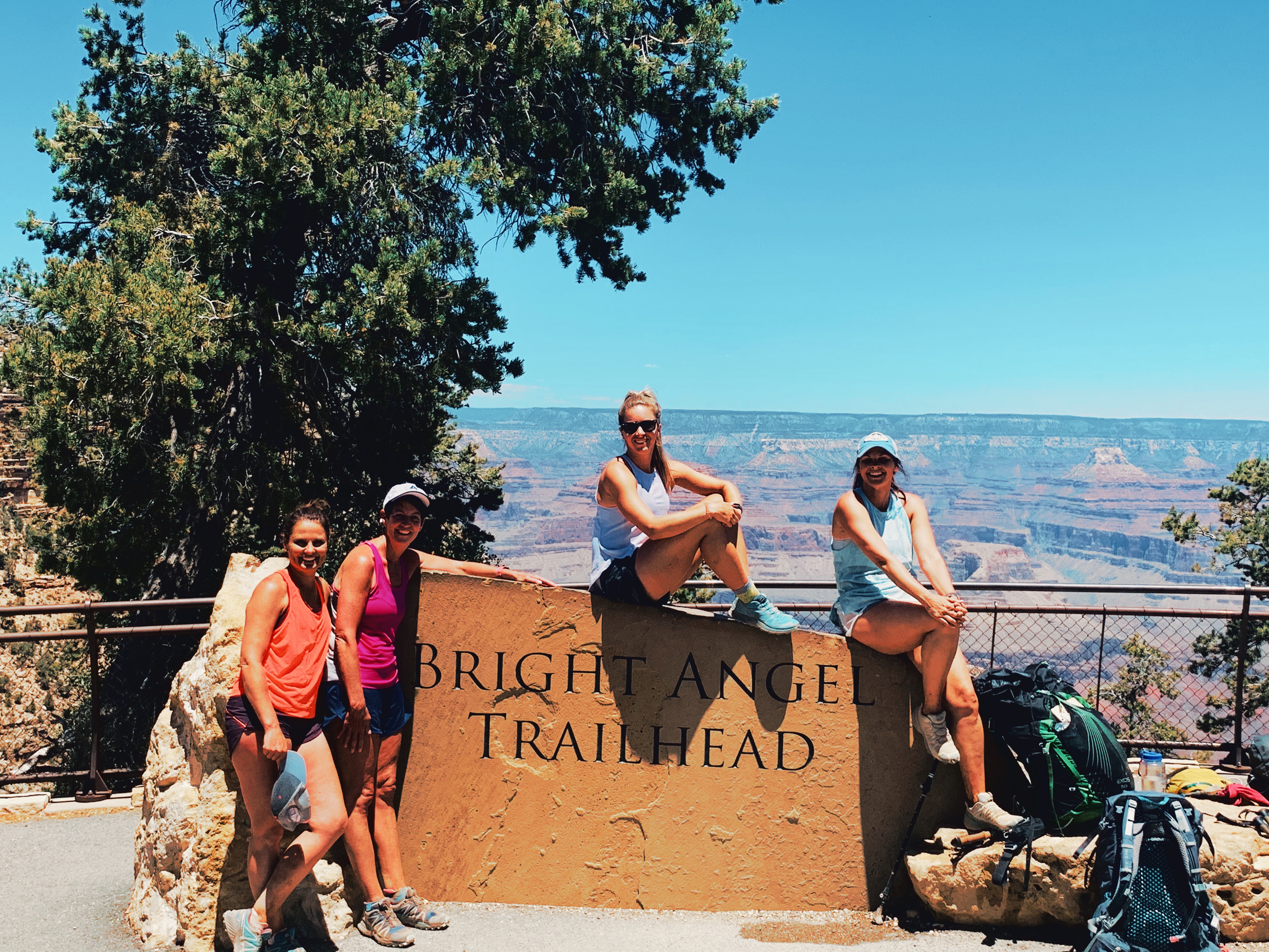
Then at mile 1.5 (where the last rest stop/water area is), we got our cooling towels re-wet for our necks for the final ascent! This is where you start running into the families and people hiking in jean shorts and flip flops so you know you aren’t overly far from the top (although still a good amount of time away). Everyone coming down was asking how far it was to “the river” and was thinking they were going to hike down to it. We warned everyone we could that it was not meant to be taken lightly and down is optional but up is required! We saw many of these people at the top shortly after we made it stating that the 1.5 mile resthouse and back up was well enough for them and they were glad they took our advice and didn’t venture further down as they weren’t prepared. We saw SO many people going down without water with them on a very hot day. This is my PSA–BE SMART! Anyway, back to the climb! We eventually made it to the first tunnel that is halfway between the 1.5 mile resthouse and the top which continued to give us hope. Then 0.7 miles (which felt like an eternity) later, we got to THE TUNNEL (if you know, you freaking know). The tunnel at 0.1 to go to the top. The tunnel where I stayed for a few minutes capturing and documenting that moment. I was so happy to see that tunnel! Then, I passed the “puking sign” and then emerged at the top a freaking hero in my own mind on the South Rim.
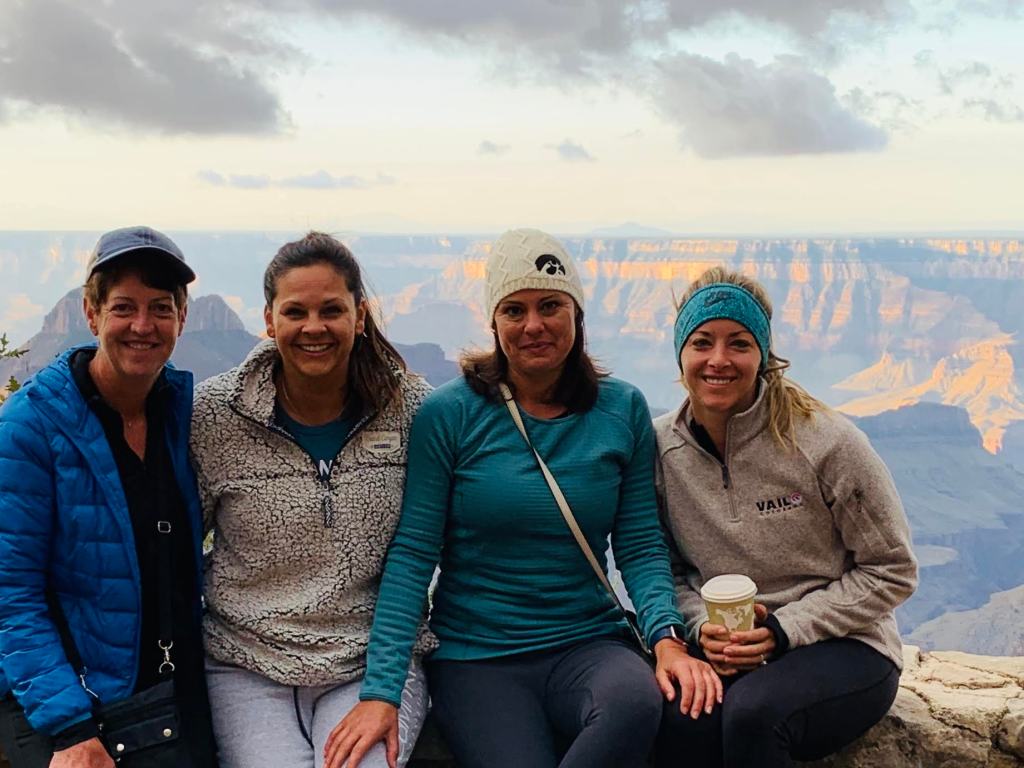
After 27 miles, 6000 feet down, a 5000 foot climb back up, about 4 gallons of water each, too much beef jerky, Nuun, and nuts, we did it. We seriously did it! We completed our first ever R2R across the Grand Canyon. We have things we’d definitely do differently and lessons learned but THAT is part of the experience! Immediately after, while drinking prickly pear margaritas at El Tovar Lodge, we said never again, we had seen what we needed to see. Fast forward one week later and we couldn’t wait to get back to the canyon and are already talking about even doing Rim-to-River-to-Rim via South Kaibab to Bright Angel some weekend. In all, the canyon has our hearts and it is officially the hardest thing we’ve ever done! I can’t express how grateful I am for getting to share this experience of a lifetime with three of my best friends! I know this was THE longest post ever but I hope it helps you envision this adventure and even inspire you to explore a bit of the Grand Canyon yourself someday! Check out my recap video with live video footage within it here!
Go explore, my friends!
PS: R2R logistics, packing list, itinerary in separate posts!

Good job! Doing it in 2 days requires youth, which I no longer have (I’m 59). We did a South to North R2R May 31-June 5, exiting the North Rim the first day it opened post-covid. Side hikes up Clear Creek and to Ribbon Falls. I promise you, N-S is way easier. (Did that last year). We probably saw that same Ring Tail Cat about midnight at Bright Angel CG!! The one picture I missed. Next trip – Timberline Trail around Mt. Hood in Oregon next July! Keep moving!
LikeLike